Looks cool from the Highway. Great for bragging rights. Not recommended in summer. Ski ascent in the winter would be better.
Quick Stats
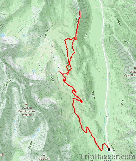
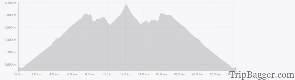
Distance: 24.4km
Height Gain: 846m
Round Trip Time: 4h36m
Kane Ratting:
South Ridge – Moderate – some exposure
North ridge – Moderate
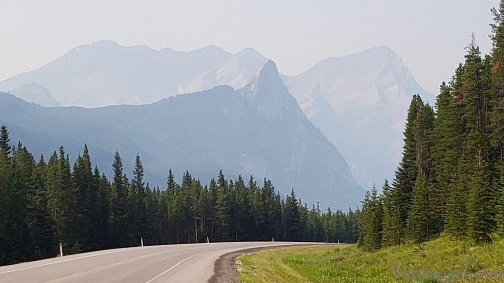
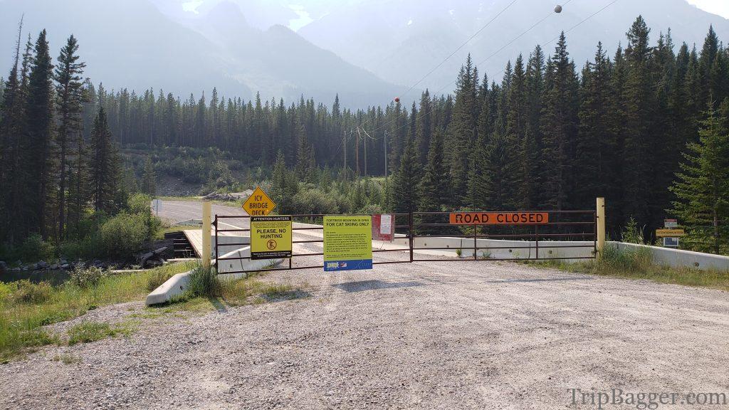
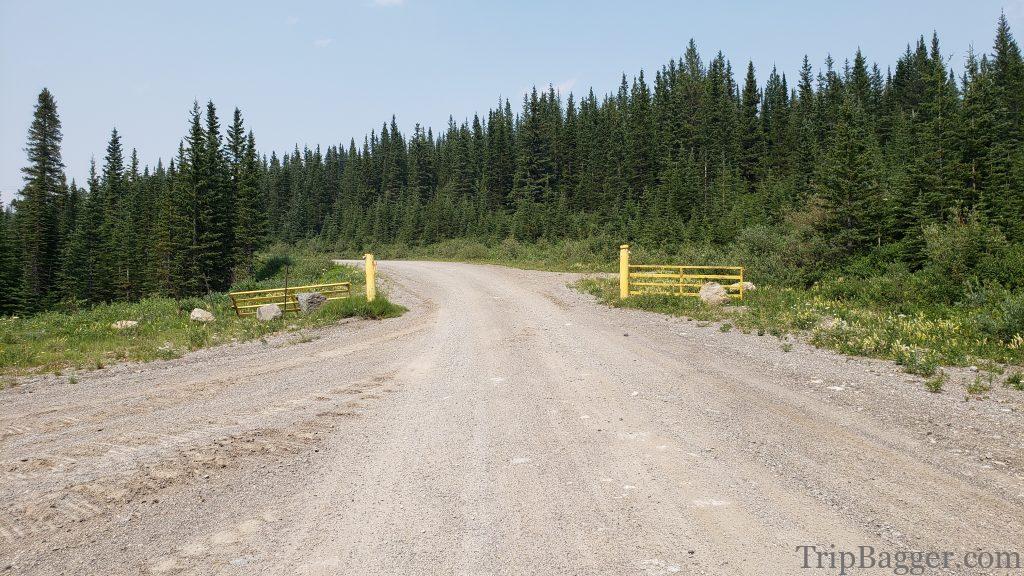
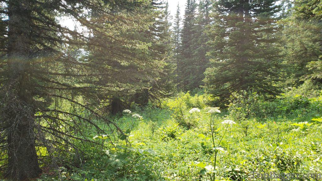
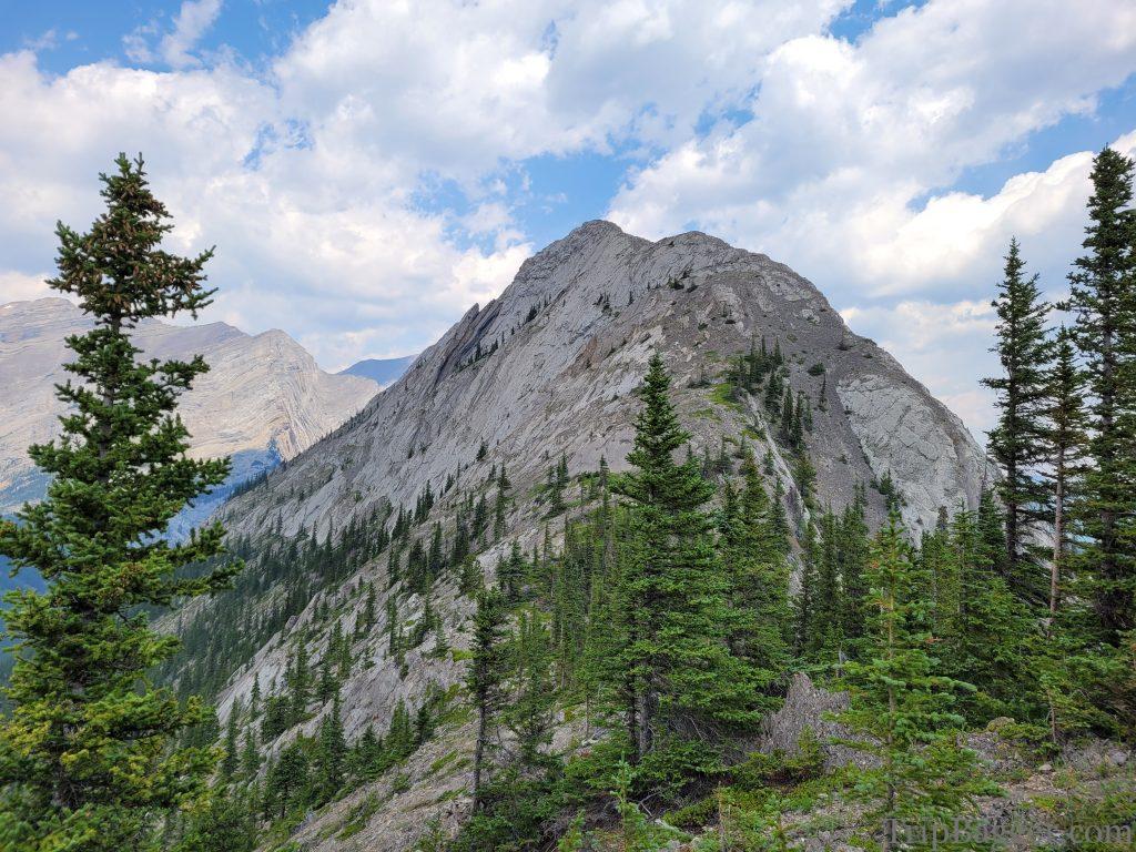
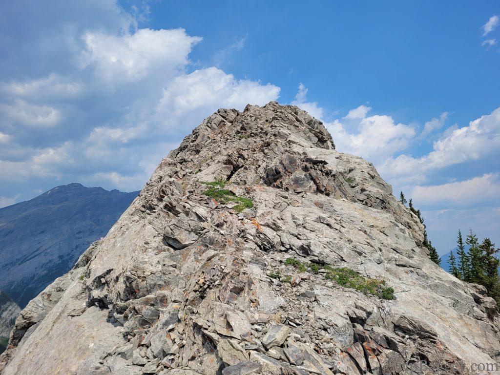
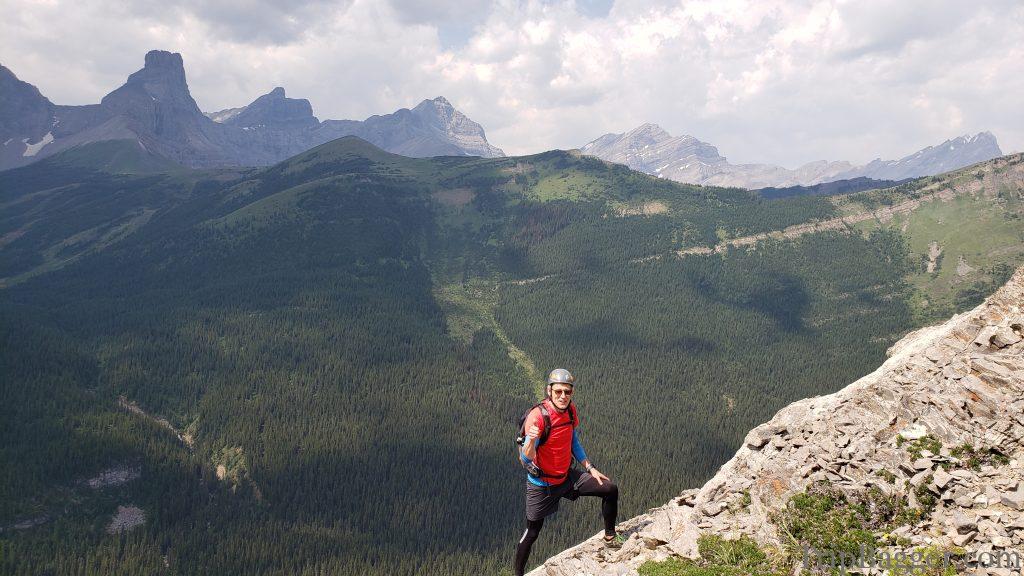
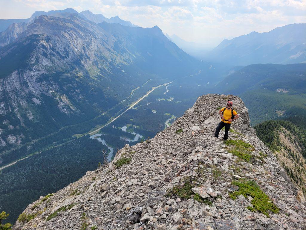
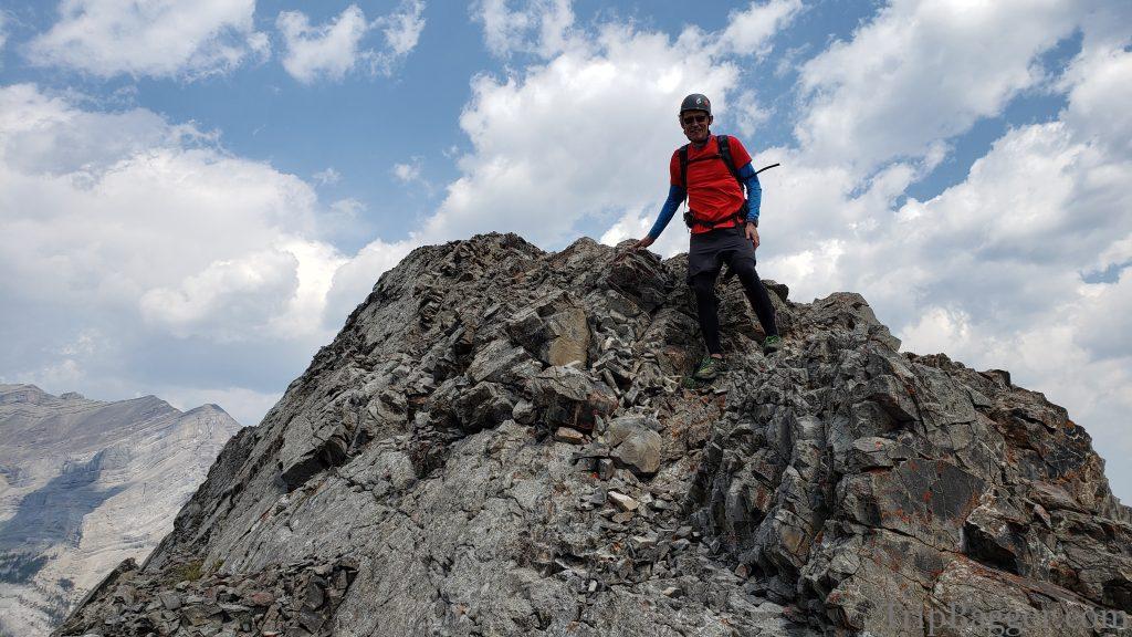
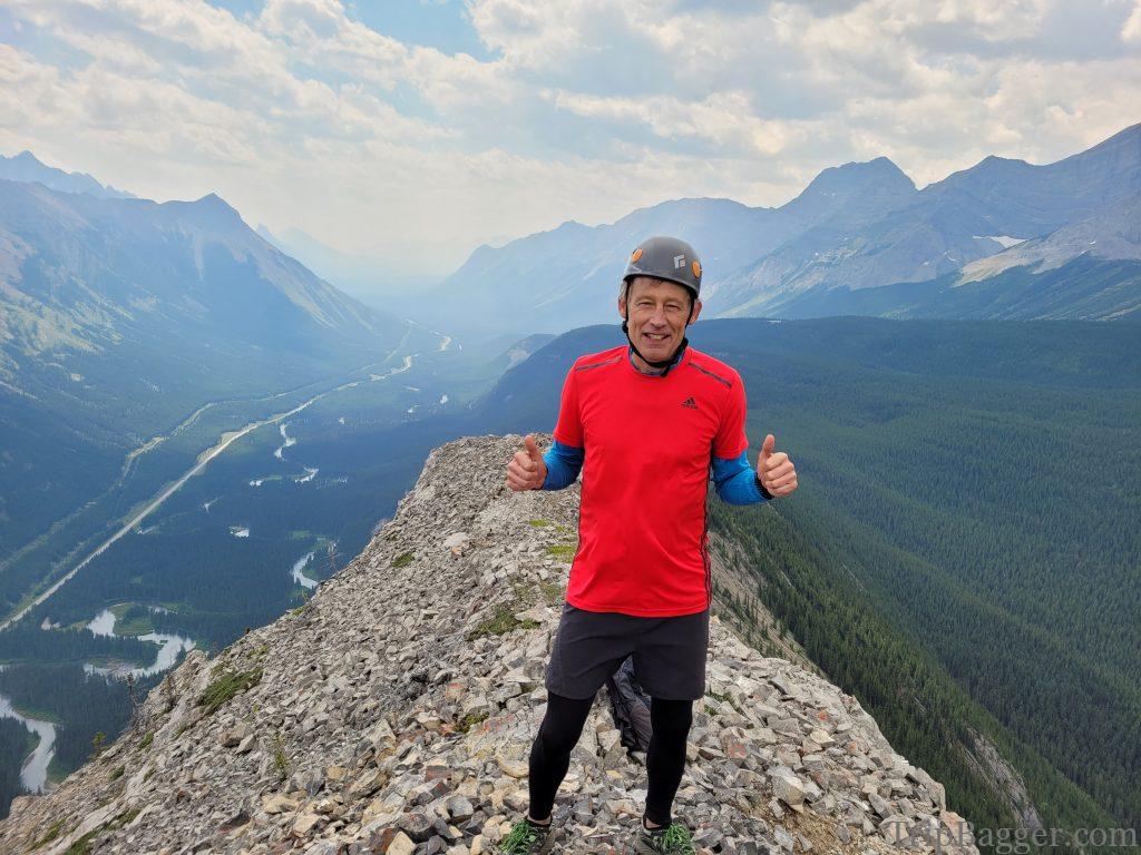
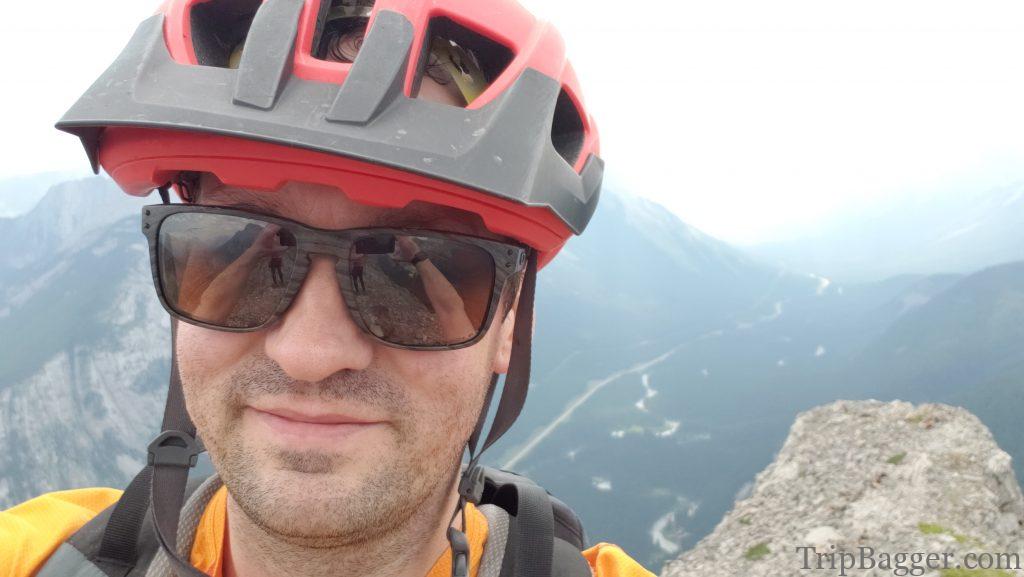
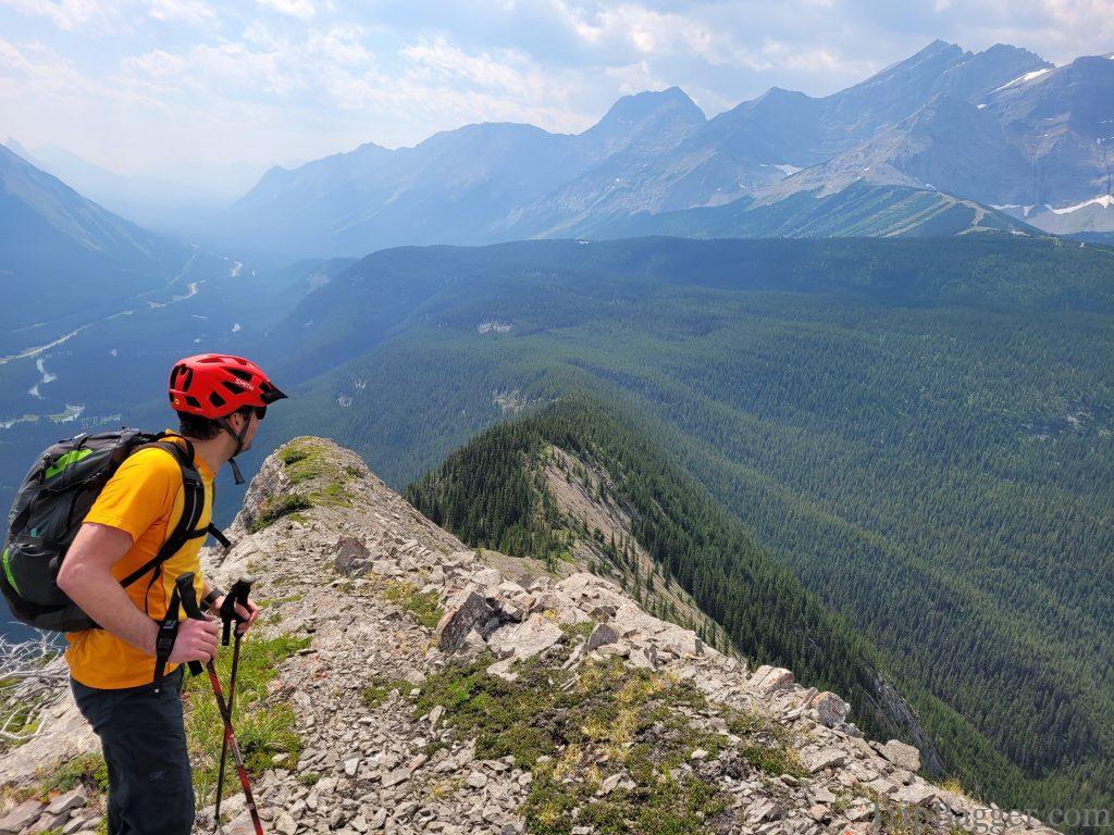
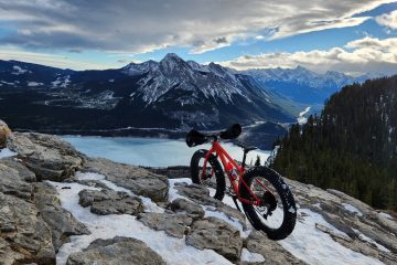
The spoon needle is a striking peak that you pass when driving down highway 40. It stands alone and is narrow and pointy like a shark’s fin. Every time I drive by the spoon needle, I feel the need to inform people I have stood on the summit because it looks so cool from the highway. My friend Phil on the other hand likes to tell everybody about the time Shawn dragged him through the worst bushwhack of his life to stand on this narrow peak. (Apologies for the hazy picture, it was a smokey summer). There are two routes up the Spoon Needle. One from the South, one from the North. We are trying for the South ridge today which starts with a bike ride up the closed Fortress access road. For more on the bike ride up the Fortress Road, click here:https://www.tripbagger.com/2020/06/23/shawn-bags-the-fortress-mountain-road-gravel-bike-ride-kananaskis/After a steady uphill bike ride you will reach the old Fortress ski area. At this yellow gate, hang a right and you will find the drinking water reservoir. Ditch the bikes here and mentally prepare yourself for the next part of the journey. Side note: according to the local custodian, bears frequent this area, so make lots of noise. Unfortunately, I took almost no pictures of the route through the forest to the base of the spoon needle (except this one). This is mainly because we were really struggling to get through the dense forest and pictures were the last thing on our minds. As Phil likes to say, it was the worst bushwhack of his entire life. Lots of deadfall, dense alder bushes and very slow going. I’ve read of people doing this as a winter ski instead. That sounds much more appealing than the suffering we had to endure. Words can’t describe the suffer fest that is getting to the base of the spoon needle from the South. After bushwhacking for an eternity and seriously contemplating turning around numerous times, we reached the base of the narrow Spoon Needle ridge. Realistically, the bushwhack was about 1 hour. Although very short lived, the scrambly bit up the narrow ridge was fun and a very welcome change from the miserable bushwhack. Phil gives a thumbs up, elated to be out of the forest. Behind him is Fortress Ridge, which is a hike I would recommend: https://www.tripbagger.com/2016/06/04/shawn-bags-fortress-ridge-kananaskis/Almost on the summit. In the background on the left is Opal Ridge North: https://www.tripbagger.com/2022/08/26/shawn-bags-opal-north-kananaskis/View of the typical terrain as we head up the narrow ridge. What about the ridiculous name for this mountain, the Spoon Needle? I just automatically assumed it had something to do with drugs but apparently I am wrong. According to the wisdom of the internet, it was named by Graham Suffield as he thought it looked like the back of a spoon from the East and a pointy needle when viewed from the South. Hence, Spoon Needle. And on the summit! Phil has increased the number of thumbs given by 100%!Which of course means the traditional summit selfie makes an appearance. The smoke from BC forest fires starts to roll into the valley behind me.As we start our decent the realization occurs that we have to make the same 1+ hour long bushwhack back though the dense forest seen behind me to get back to our bikes. Eventually, we make it out in one piece but not without scratches and cuts from trees. I assume Phil will never talk to me again. Every time I pass the spoon Needle while driving on highway 40, I smile as I’m proud to have stood on the summit but then think to myself…. Never again.
1 Comment
Phil · April 8, 2023 at 4:25 am
I hate you Shawn 🙂 Sincerely Phil