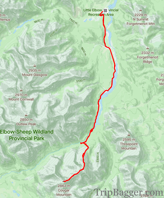
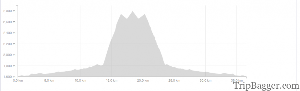
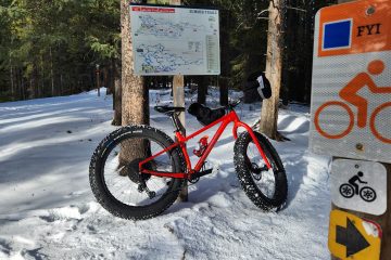
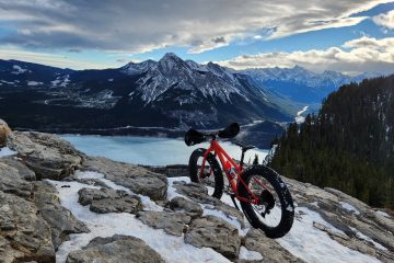
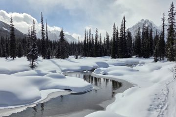
Right from the parking lot you can see the first, and false, summit of Cougar Mountain. I’ve put a little red arrow here to give you an idea of how far away it is. Given the distances involved, you may want to consider alternate transport, like a horse. I went for a bike instead. I imagine a bike is cheaper, but I’ve never bought a horse to be sure. (Image credit – Phil Daum)The day starts by crossing the Herald Chapman bridge. From here, it is a nice 13.6Km bike ride which can be done in about 1 hour at a comfortable pace. For more info on the Elbow loop bike ride click here: https://www.tripbagger.com/2021/10/09/shawn-bags-the-little-elbow-big-elbow-loop-kananaskis/ All of the bridges on the approach trail have been replaced since the 2013 floods. Here you can see they moved the bridge above a canyon so it will hopefully survive the next major flood event. The false summit of Cougar Mountain is visible on the left.This is the bike drop just past 13Km. We elected to ride a bit further and start from there instead. If you are lucky, you might find a faint trail. Head up through the forest. Once you get to tree line the route becomes more obvious.Shortly after climbing above tree line, the false summit comes into view. The route follows the left side and works its way through the cliff bands to the first summit.Although taken on the way down, this gives you an idea of what the ascent ridge is like. You can also see the trail to the left of the river we rode our bikes in on (or your horse). Near the top of the picture is the parking lot, a long way from the car. It was this spot where the wind really started getting strong. So much so that it blew my sunglasses right off my face and over the cliff. We walked around the bottom of the cliff on the way down but didn’t find them. My sacrifice to the mountain gods. Almost off the sunglass stealing ridge and up the scree slope to the first summit. With the strong winds we experienced, the going was a bit slower than usual.One Phil for scall. He is waiting for me wondering why I am so slow. I’m taking pictures Phil!On top of the false summit. The true summit seems a long way off. I’m trying to keep my phone warm as the battery keeps freezing.This means losing hard earned elevation and then regaining the true summit. Behind Phil you can see the typical terrain. A better look at the terrain on the way to the true summit. Phill likes to walk backwards to add to the challenge, or I just took this pic on the way down. Impossible to say for sure.Crux of the ascent. On the Summit, finally! In the background on the right is Banded Peak. Home of the Banded Peak Challenge, a 40+Km race to the mountain’s summit. I just so happen to know a guy who won this race.The winds still being very strong and cold, I attempted to see if I could attain flight from the summit. It’s probably for the better that I couldn’t.Traditional summit selfie!The views are pretty reasonable. Snow in the higher ranges is starting to stick around.A look back at the way we came up. The parking lot is on the left where the riverbed disappears. The false summit is on the right. Sunglass stealing ridge in the middle. Unfortunately, this means we have to head back down and up the false summit again. Given the very strong and cold wind, we don’t linger for long and start the long journey back.


1 Comment
Shawn Bags the Little Elbow – Big Elbow Loop – Kananaskis – Trip Bagger · January 22, 2022 at 8:40 pm
[…] part of the loop, Cougar Mountain comes into View. You can read more about summiting Cougar here: https://www.tripbagger.com/2021/09/30/shawn-bags-cougar-mountain-kananaskis/Not much further ahead, at the 28.5Km mark is the turn off for Banded Peak. All but one of the […]