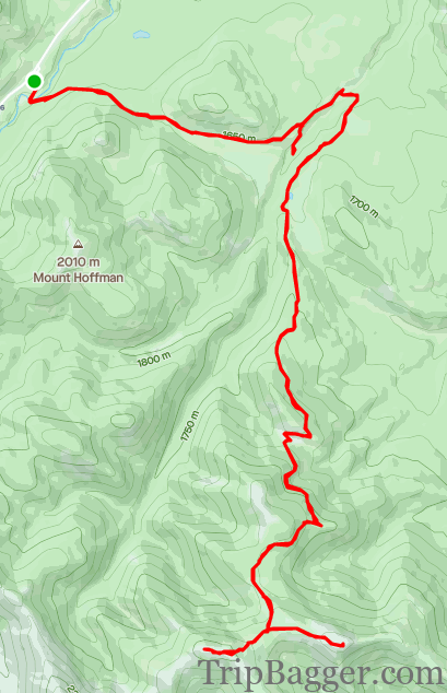
Mostly doublewide fire road mountain bike ride in the front ranges. Add in Hill 651038 on foot for an extra 1.6Km + 113m of gain.
Quick Stats
Distance: 29.56Km
Height Gain: 1053m
Round Trip Time: 4h11m
Surface Type: Dirt/Mud Fire road
Weapon of Choice: Mountain Bike – Bonus points for full suspension
Resources: Jillean Daffern Kananaskis Trail Guide / Alberta Parks Website
The trail starts at the Indian Oils parking lot. Last week, I was on Mount Hoffman, which also starts here, and could see the lookout on Junction Mountain. It looked very far away, but I figured I would return with a bike and have at it. If you prefer a shorter hike, check out Mount Hoffman here:https://www.tripbagger.com/2021/10/26/shawn-bags-mount-hoffmann-kananaskis/When you reach one of the first clearings, the objective comes into view. It is difficult to make out in this picture, but you can see the lookout building on the center peak. It looks like it is very far away from here, mostly because it is. Onward!The first river crossing is at roughly 3Km and takes about 20 minutes to get there at a moderate pace. The river was frozen which kept my feet dry. Right beside the river crossing is a nice waterfall. This would be a great place to hang out on a hot summer day. Not pictured but the next major junction is at the ~5.3Km mark, hang a right when you reach it; about 45min to get there.Most of the trail is in the forest until you hit this col around the 10Km mark. Allow about 1.5 hours to get here. The views are short lived however, back into the trees not long after. It was here where the snow just became too deep to carry on with my bike. Although riding down the hill in the snow was a riot, heading up was a suffer fest. So I stashed my bike in the trees here and started out on foot. I imagine in the summer getting to the summit by bike the entire way would be possible. You can just make out the fire lookout on the summit from here. Still a fair distance to go. Finally, out of the trees! I assumed I would be heading up the ridge on the right as I didn’t do much research on the route. I was wrong, and the trail hangs a left after heading over this ridge. Nearing the top. I was jumping from rock to rock to try to keep my feet dry. I was just wearing my biking shoes instead of waterproof hiking boots. On the Summit! Fire lookouts almost always have excellent viewpoints. Which of course, means it is time for the traditional summit selfie.Buddha watches over the mountains.Not a bad place to take care of business. Mount Hoffman, where I was the previous weekend, can be seen way off in the distance. It is one of the small green hills. More on Mount Hoffman here:https://www.tripbagger.com/2021/10/26/shawn-bags-mount-hoffmann-kananaskis/Once last moment to enjoy the view of the foothills with Buddha.After traveling such a long distance, I decide it only makes sense to also visit the hill seen here to the left. Officially named Hill 651038 after its grid reference on the map. This adds roughly 1.3Km and 120m of extra gain. View from Hill 651038This calls for a second summit selfie! From here, you can see the trail leading up to the fire lookout on the top of Lookout Junction where I was just a few minutes ago. The wind is really starting to pick up, so it is time to head down.
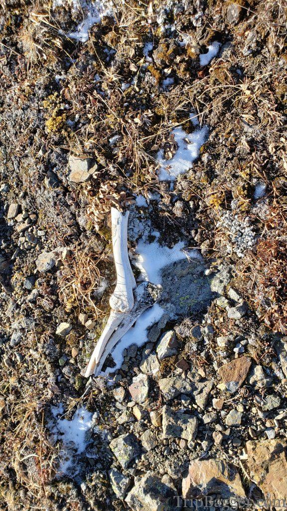
I’m not sure how these bones got here, but I decide it is definitively time to leave now. One can only assume there was a sasquatch in the area at some point. The ride back down was fast, snowy, and muddy. A great way to travel!


1 Comment
Shawn Bags Mount Hoffmann – Kananaskis – Trip Bagger · February 27, 2022 at 8:31 pm
[…] the distance I can make out a fire lookout on a peak. Note to self: go visit this lookout someday. https://www.tripbagger.com/2021/11/05/shawn-bags-junction-mountain-lookout-kananaskis/ Categories: HikesKananaskis HikesKananaskis Peak BaggingPeak Bagging Tags: Easy peakEasy […]