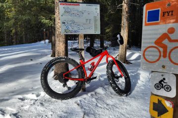
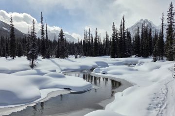
From the parking lot, you can see barrier lake on the left and barrier lookout in the background, our objective for today’s bike ride. The ride starts off by crossing barrier dam. The dam was built in 1947 for the generation of electricity, not for bike access to the mountain, color me surprised!The route follows prairie view trail up the mountain. This is a very popular trail so it is usually packed down and can be icy, tire studs are helpful. Its a long steep grind that has at least 10 switchbacks along the way. You can see my gloves are wide open, you generate a considerable amount of heat grinding up a mountain. As the route approaches tree line, the views improve dramatically. I’ve always thought the Rockies look better in the winter. Shortly after, the trail gets too steep to continue riding a bike. I put some micro spikes on my shoes for traction and start pushing. The fat bike is very fun for riding in the snow. But weighing in at over 40 pounds, it is not fun to push up a mountain. Pictures rarely do a good job conveying how steep a trail is, but I’m questioning my decision to bring a 40 pound bike up here.The trail narrows a bit and wraps around a cliff. Although it looks flat enough to start riding again, I know what is hiding around the corner. This is the steep rocky part of the trail that I certainly wasn’t going to be able to ride up. If you go around on the right side it is a bit more gentle, but this is almost certainly a carry your bike up the trail kind of situation. But at the top of the difficult part, spectacular views wait for your arrival. This location was the original spot where a lookout tower was located. Unfortunately, that lookout was a WWII internment camp lookout to watch for escapees. The internment camp held roughly 1000 German soldiers and officers. The original lookout was removed in 1982 when a fire lookout was built higher up on the mountain. From this spot you have two choices, carry on to Jewell pass or make a side trip to the new fire lookout on the summit. You know I had no choice, I have a selfie to take. The newer fire lookout at the summit. The trail I took to get here was once how supplies were transported up to the lookout. Now they are all delivered by helicopter instead. It shouldn’t be surprising that a fire lookout would have excellent views. This lookout is occupied by one person 24/7 whenever it is fire season in the Rockies. Which of course, calls for the traditional summit selfie!One more moment to soak in the views before heading back down. Highway 40 can be seen snaking it’s way down the Kananaskis valley. Instead of going back down the way I came up, I followed Jewell pass trail back down the mountain. It is narrower and sees a bit less traffic compared to the ascent route, but is a blast on a fat bike. There is one major junction on the way down, but it is signed so hopefully you aren’t going too fast and miss it. There are a few bridge crossings on the descent trail. Some have no railings, some have just one railing and others are fully built up bridges. After completing a fast descent, there is a bit of a long somewhat flat ride back to the parking lot to complete the loop. A welcome opportunity to let the brakes cool off after the ride down. I know people who have ridden back across the frozen lake as a faster return path. But given the warm weather we have had, I decided to take the safer but longer route around.


0 Comments