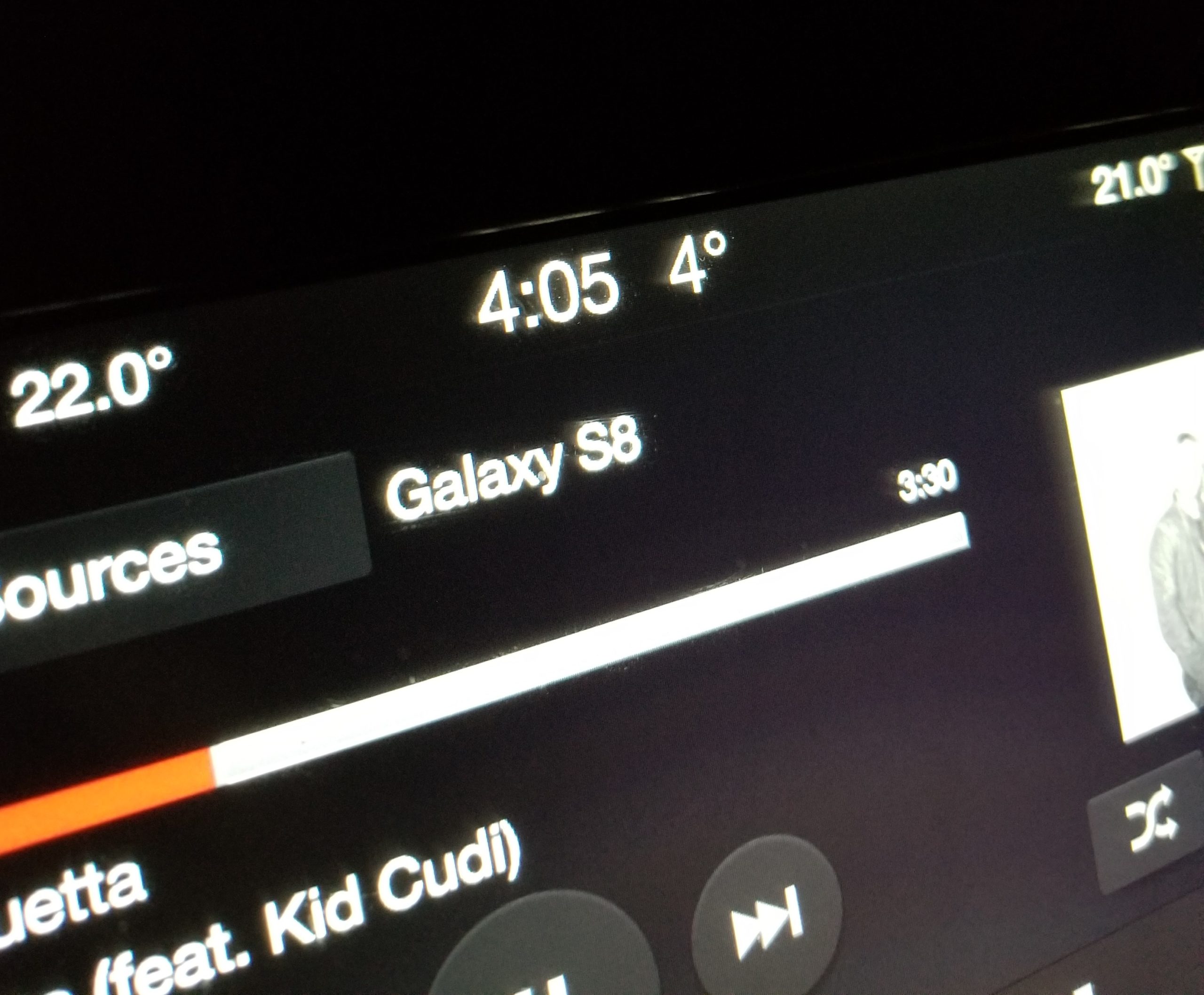
Many people climb Mount Whitney as a multi-day trip. The thought of lugging a 50 lb backpack with a tent and beer isn’t appealing to me so I decide to climb Mount Whitney in one very long day. This means getting up at 3am, eating breakfast at 3,700 feet elevation and driving to the trail-head. Having experienced over 40 degrees C just the day before, 4C feels cold. Note the time, 4:05am, time to start hiking.
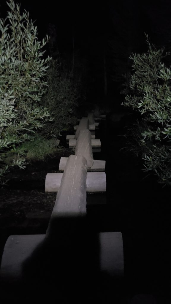
Ever wondered what it looks like hiking in the dark? Wonder no more! I spent the first few hours hiking in the dark. Fortunately for me, I scouted out part of the route the day before so navigating in the dark wasn’t too difficult. I did hear a few noises in the bushes and was pretty startled at one point to see a pair of eyes reflecting back the light from my headlamp. Thankfully, those eyes just belonged to a deer.
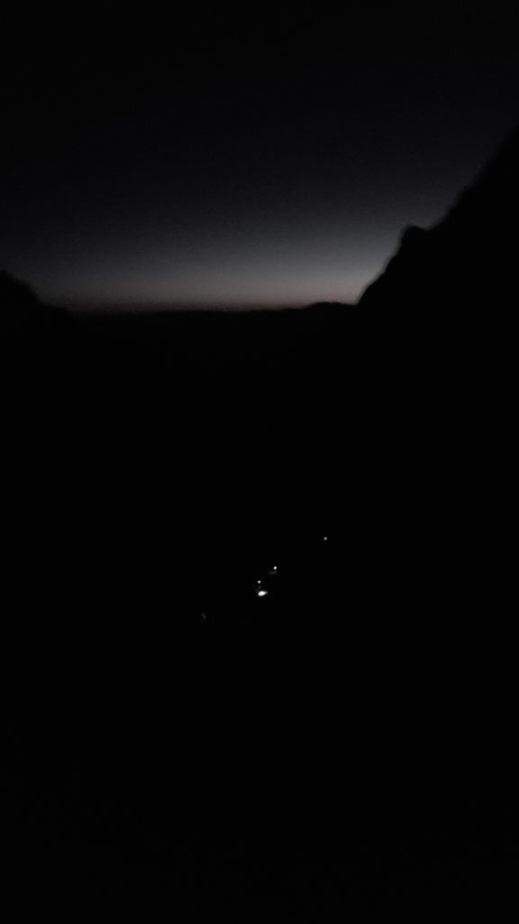
Looking back down the valley as I hike up. The white dots are other people that are hiking up behind me. Despite having a late start (most guides suggest starting at 2-3am), I passed a number of people on the way up. Moving slower at these altitudes is a good way to help ease the effect of thin air but I just can’t help myself, onward and upward!
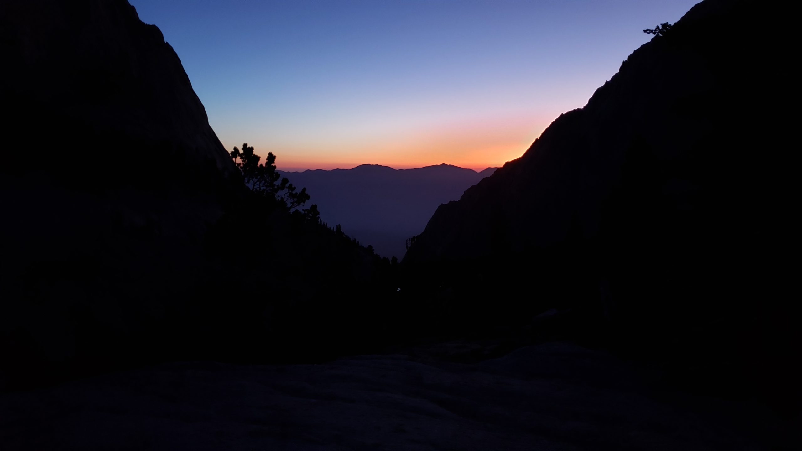
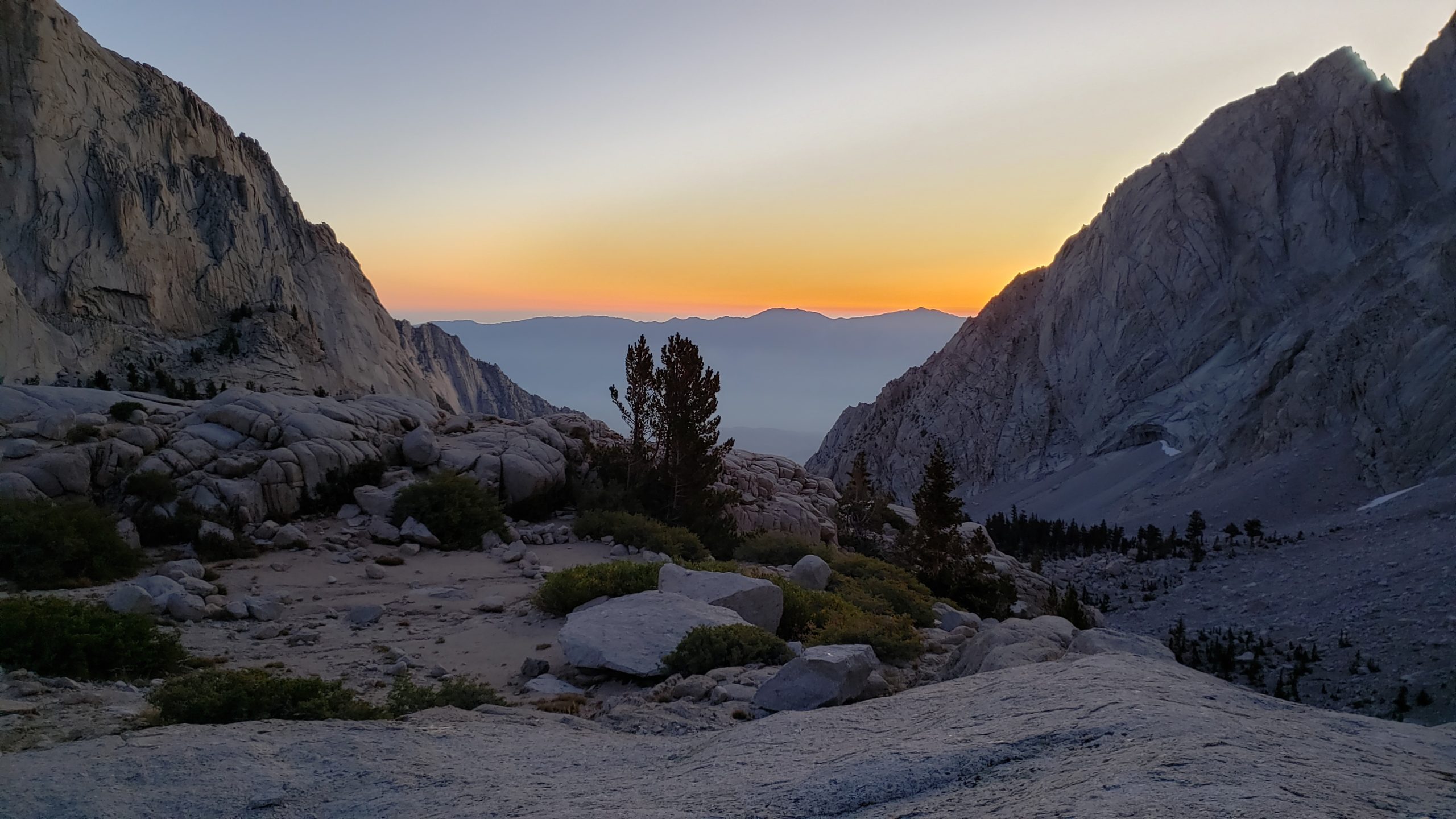
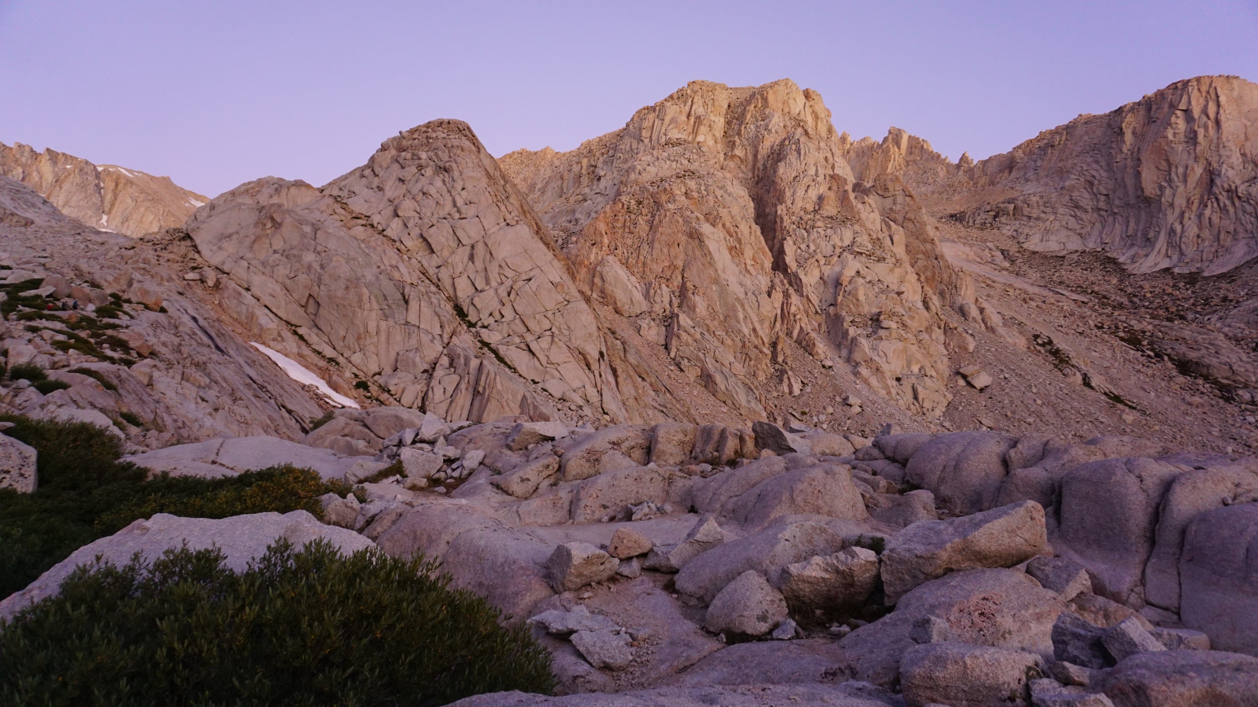
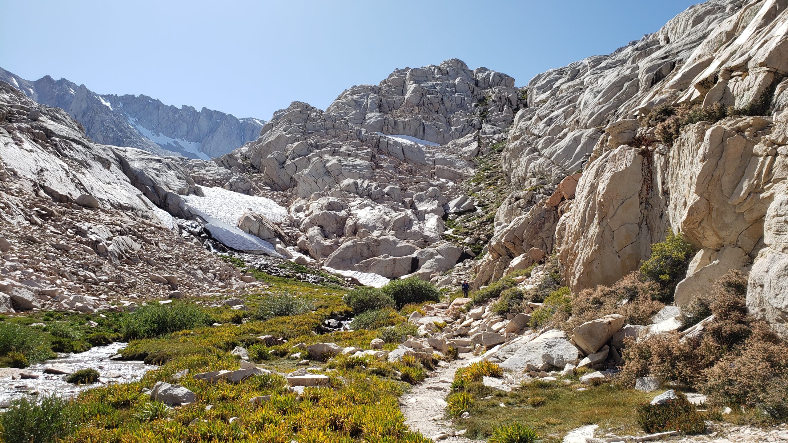
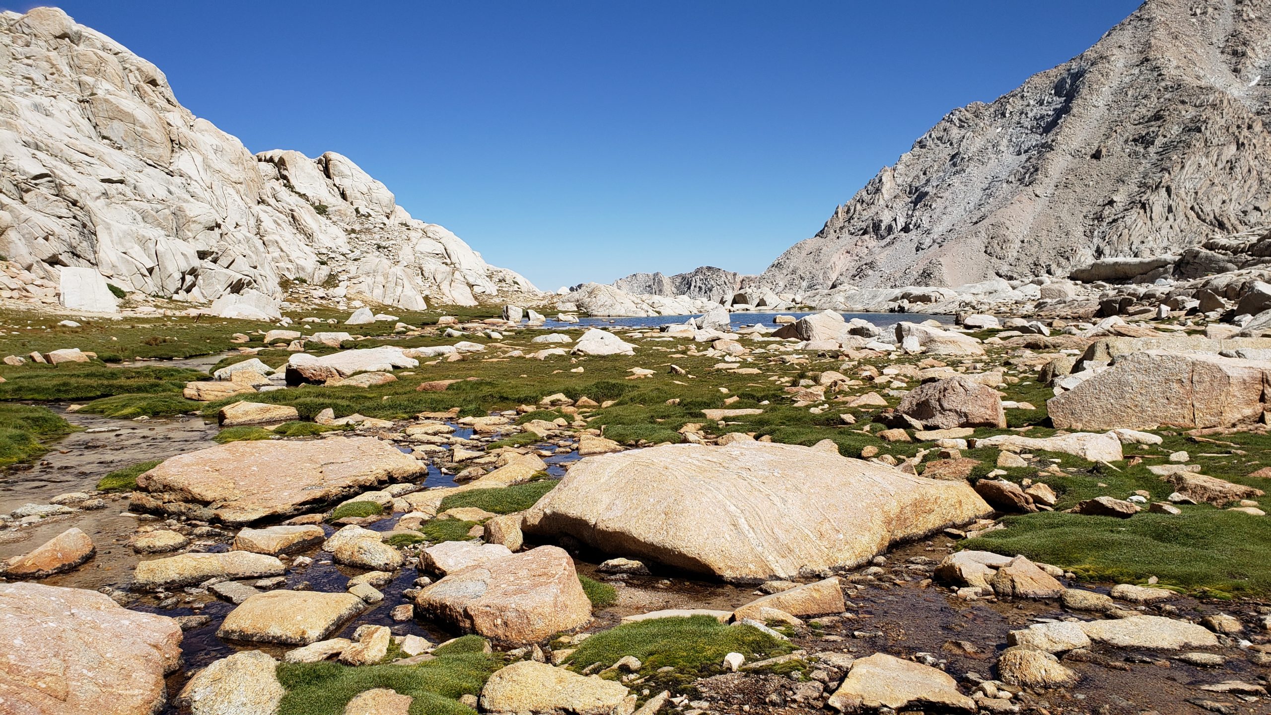
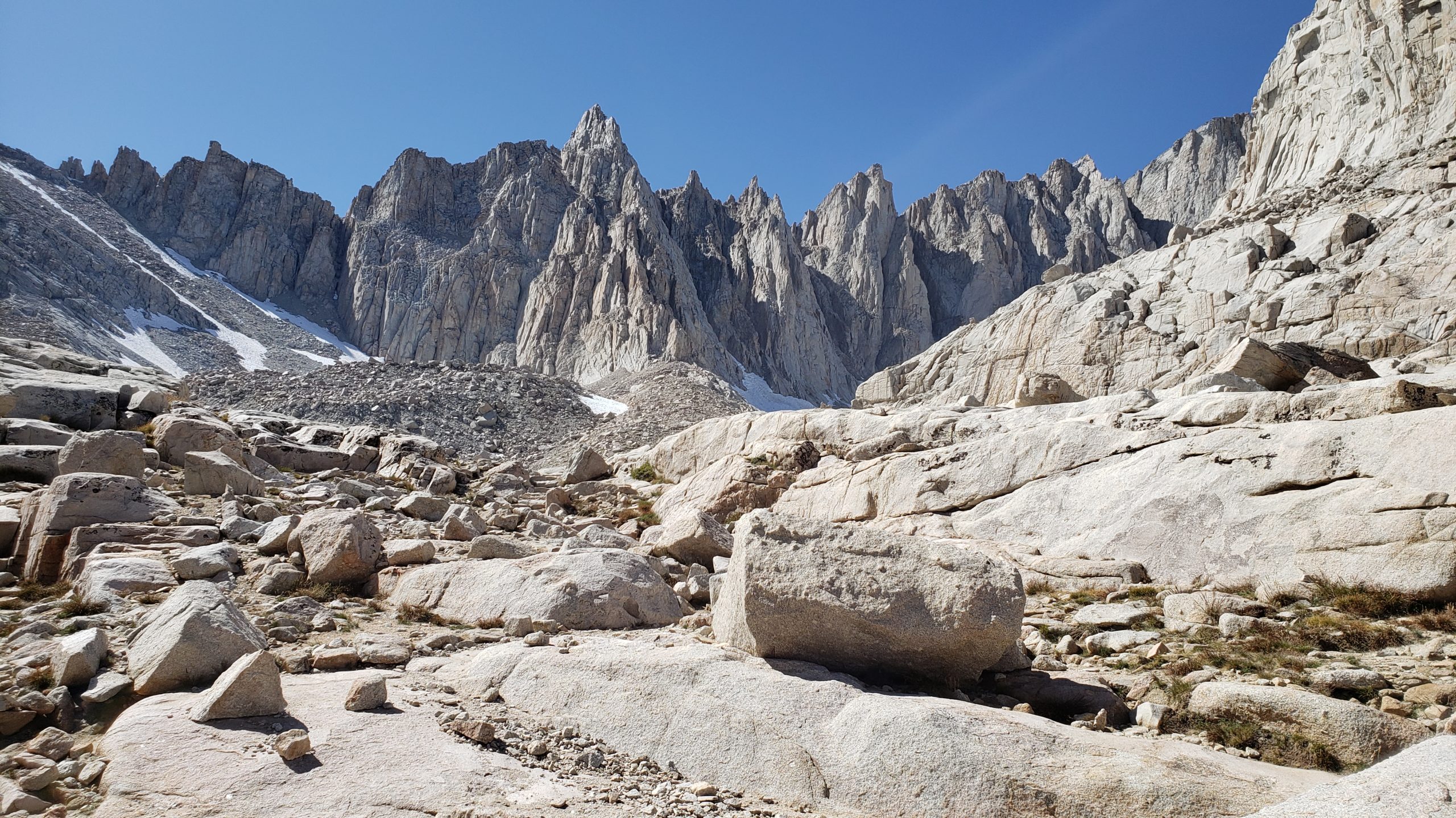
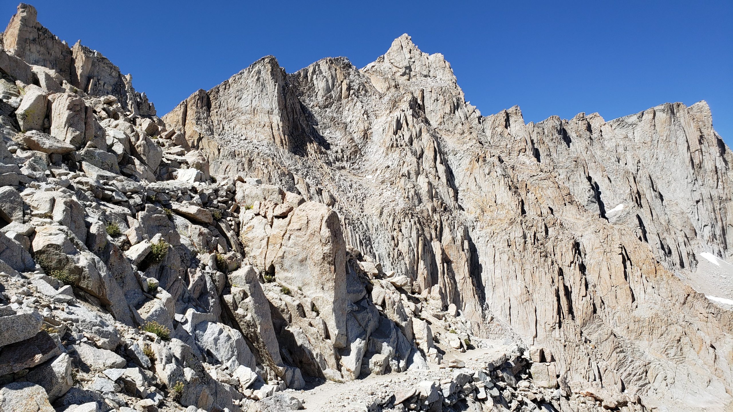
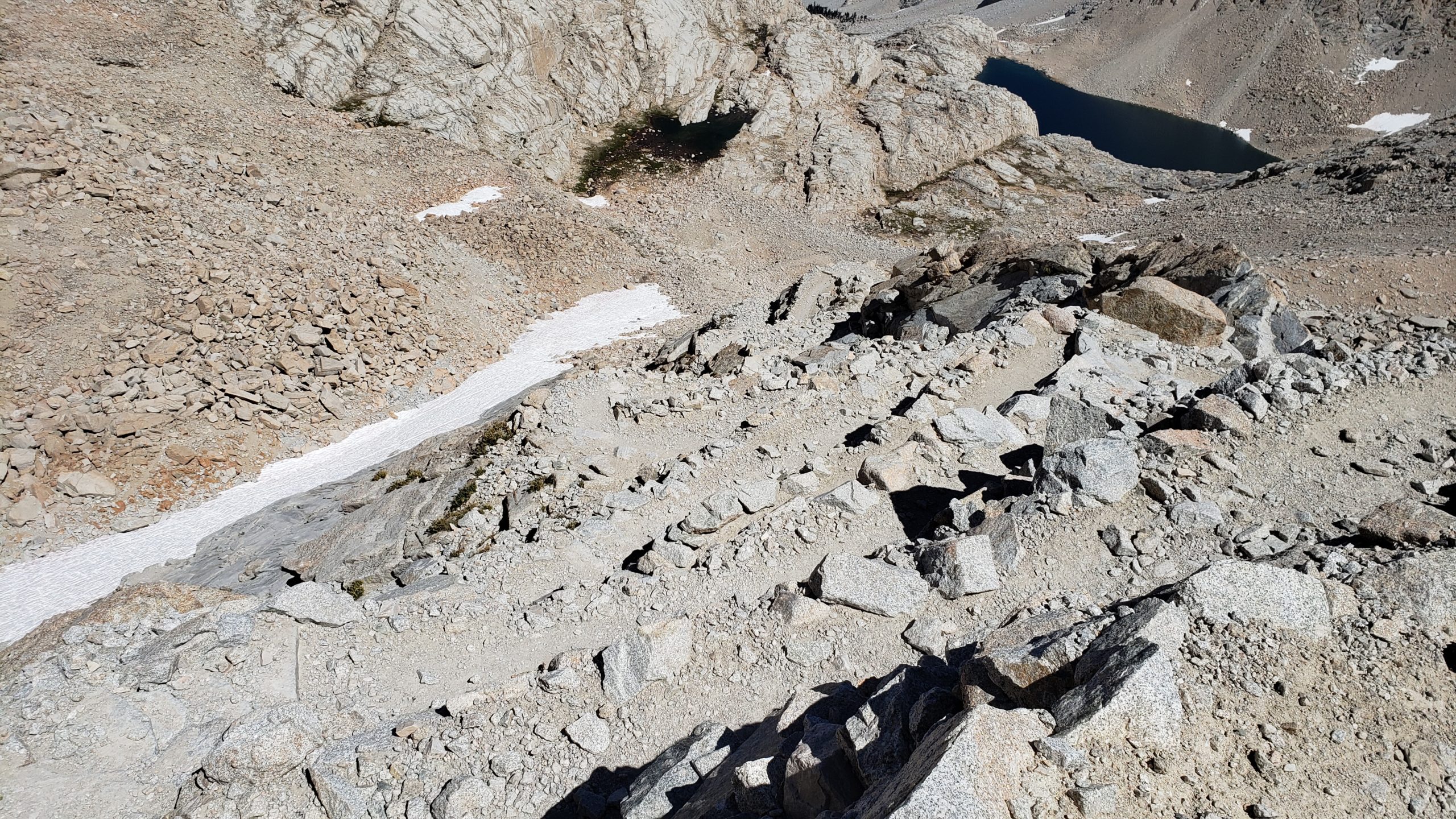
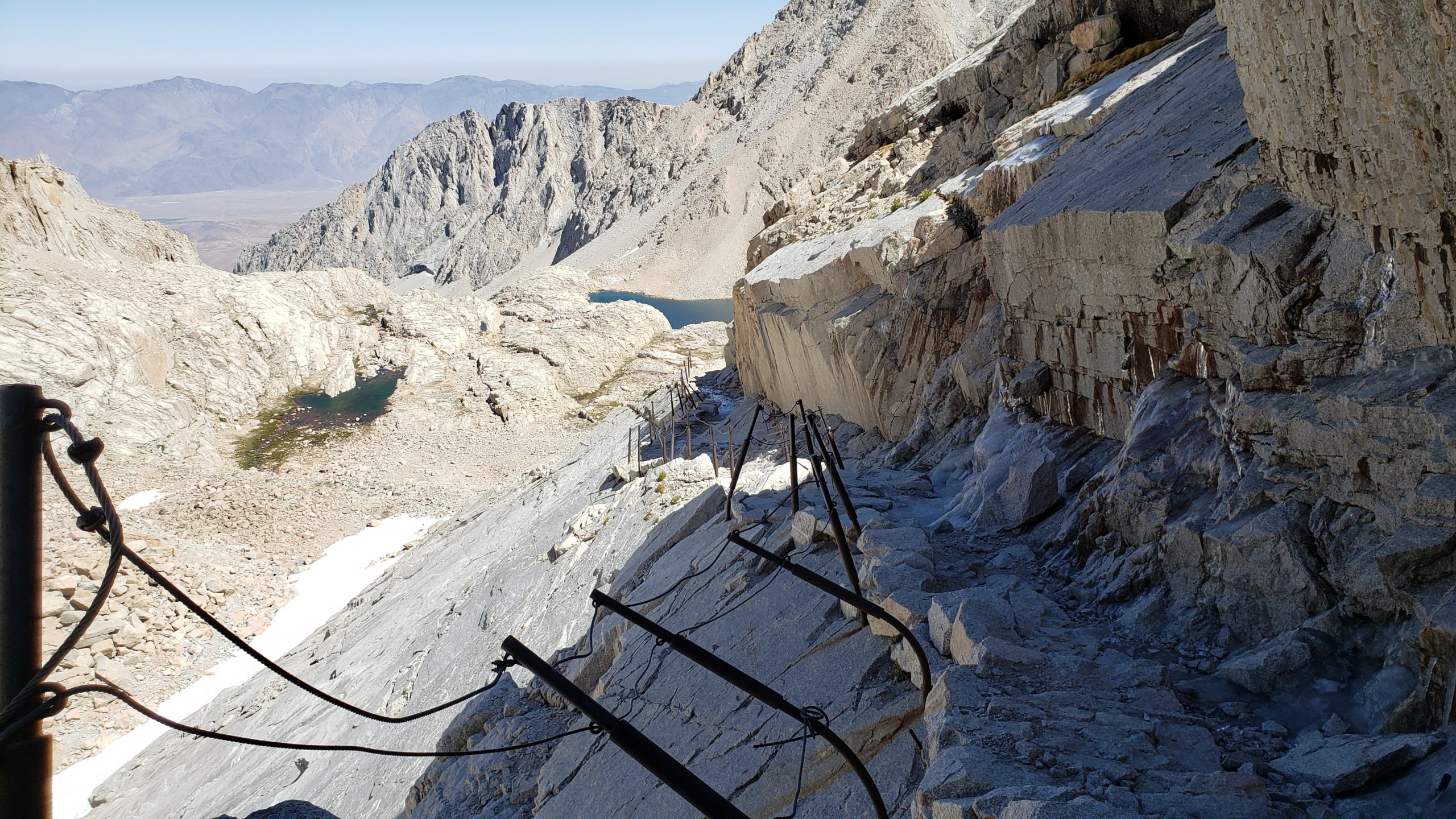
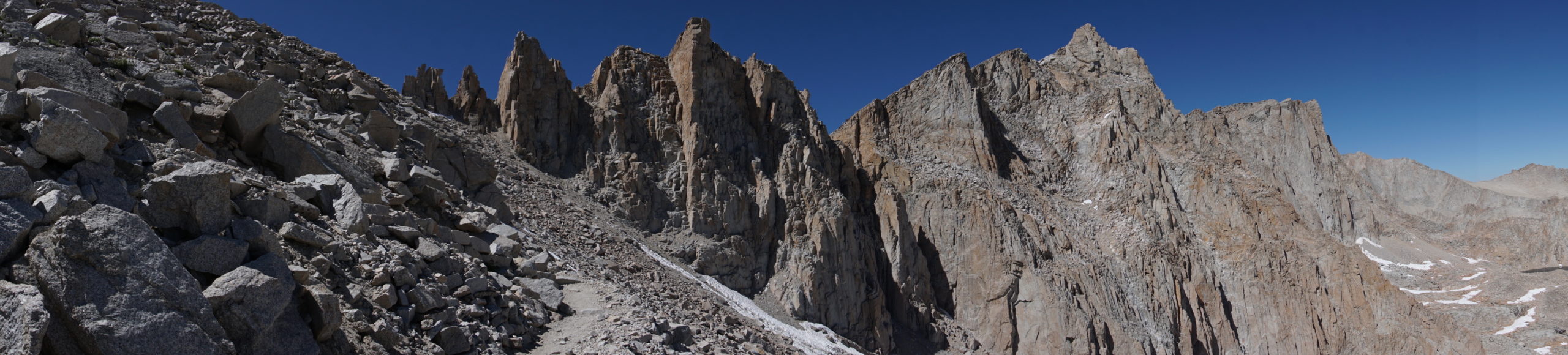
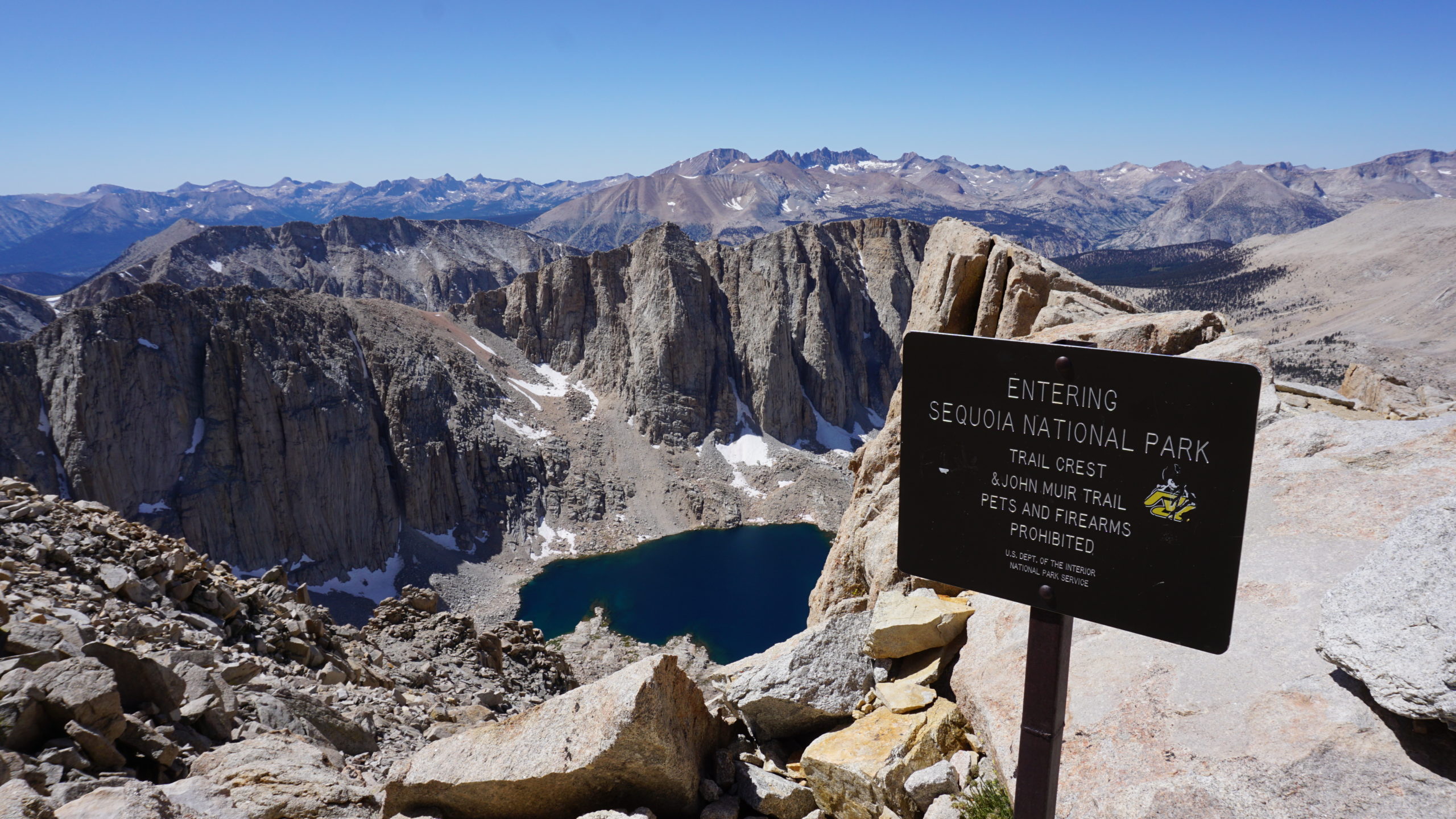
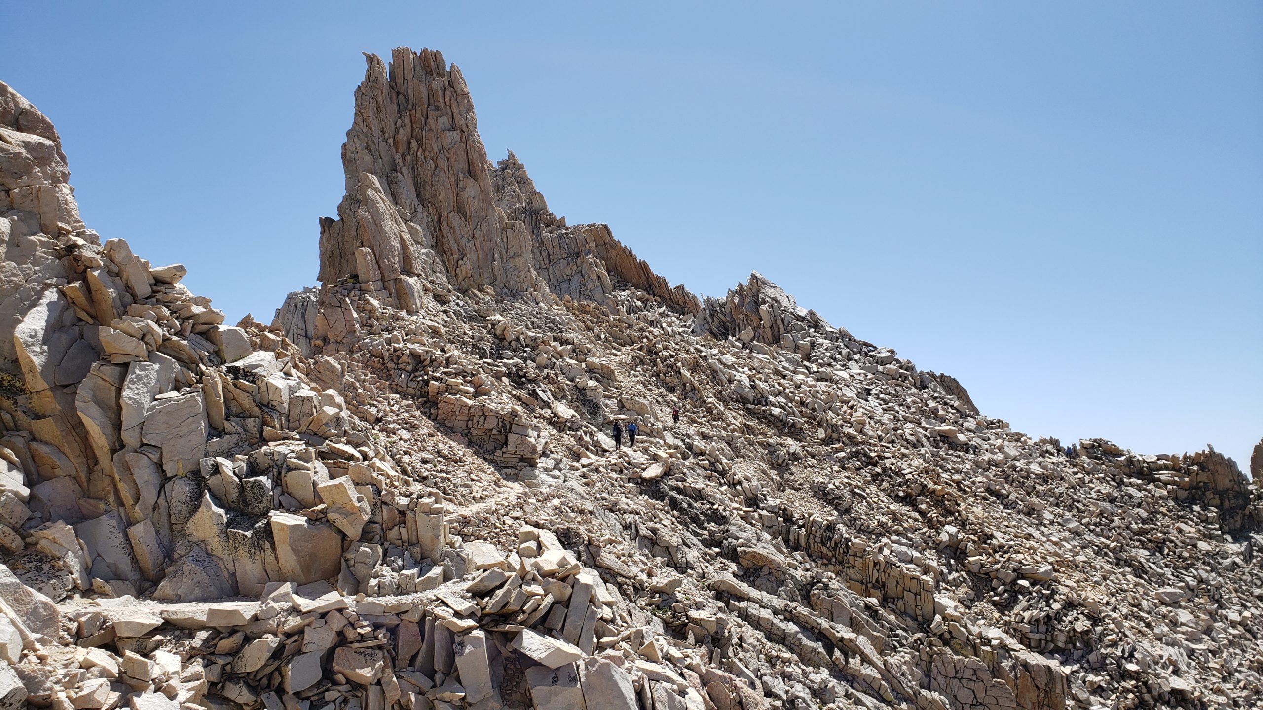
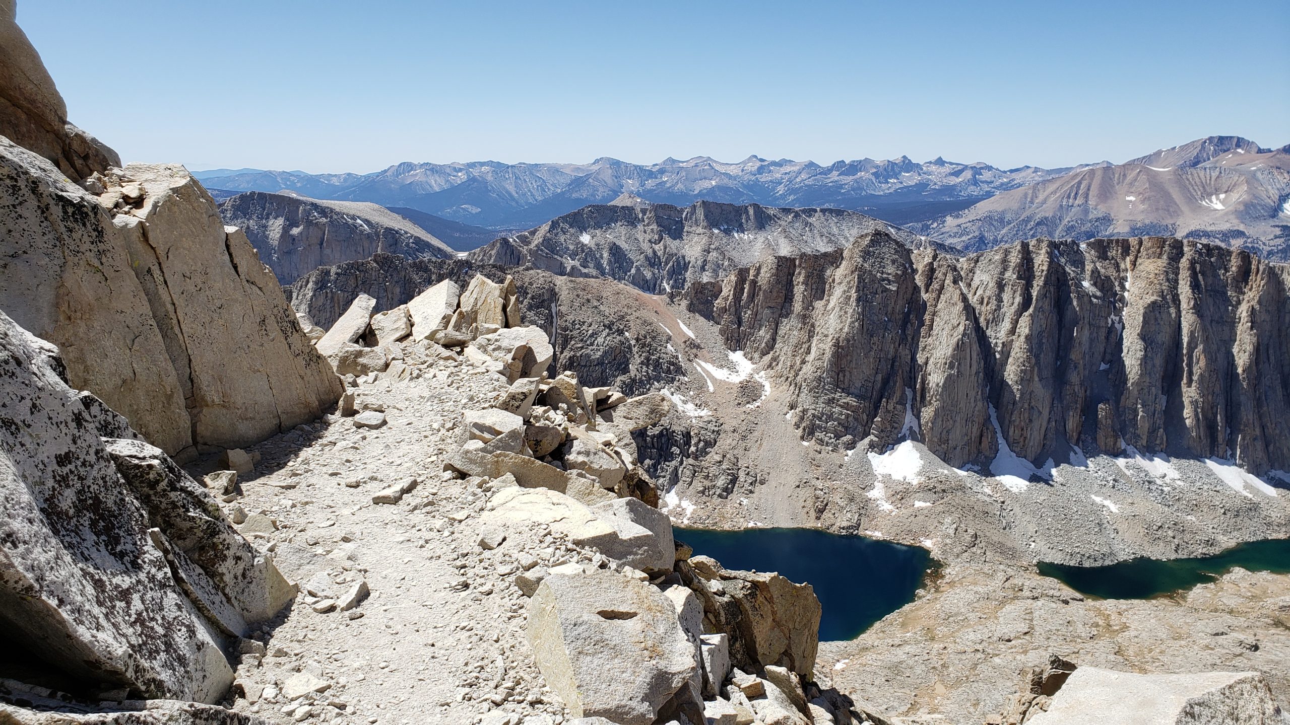
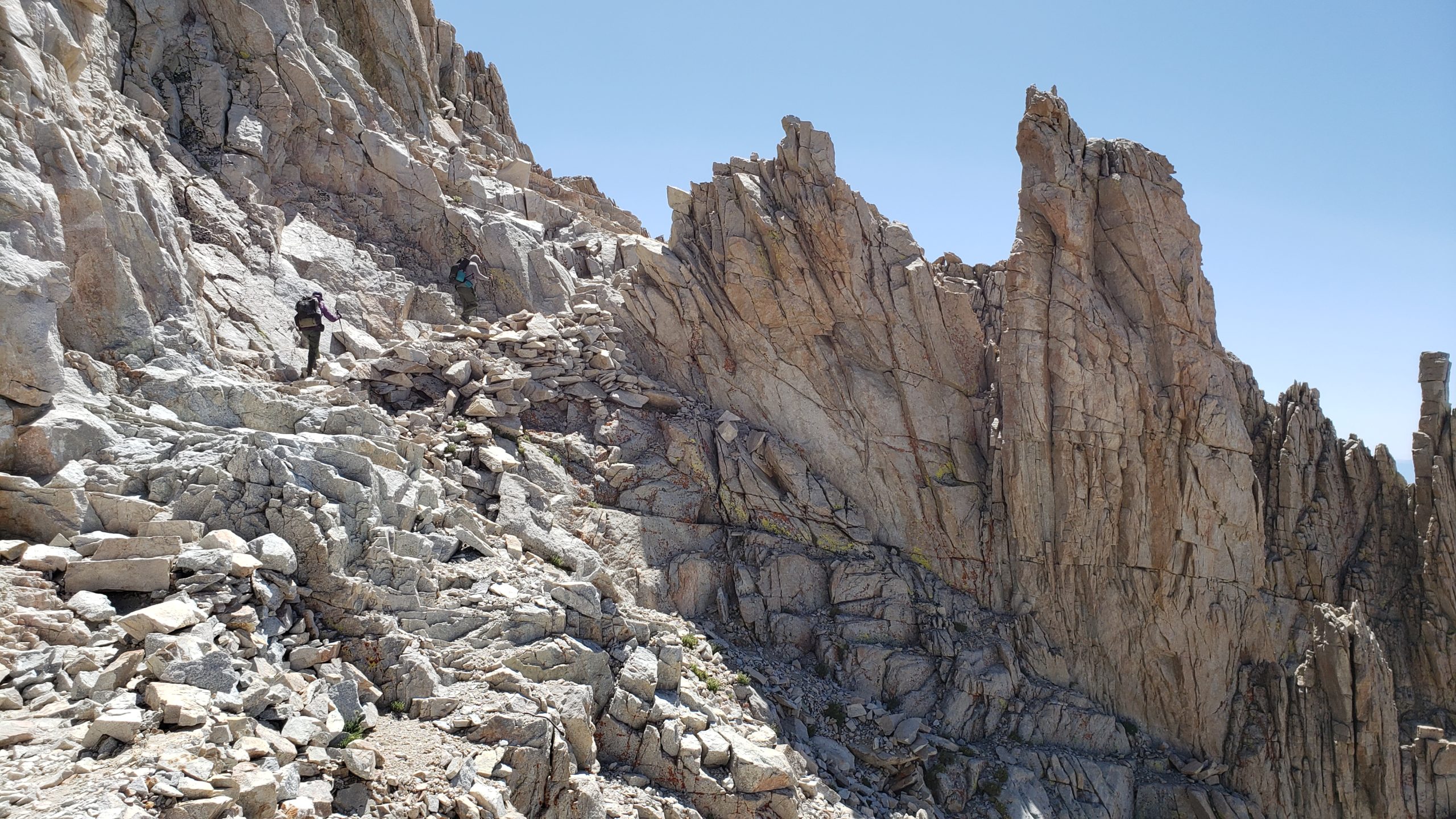
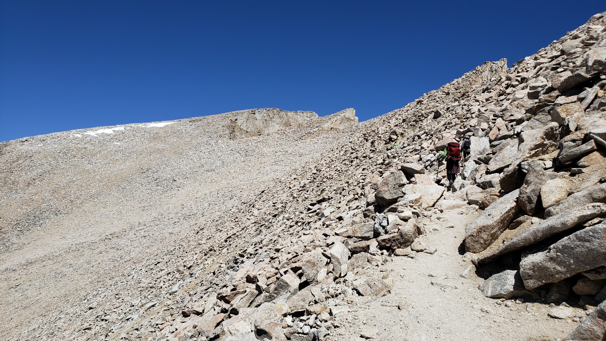
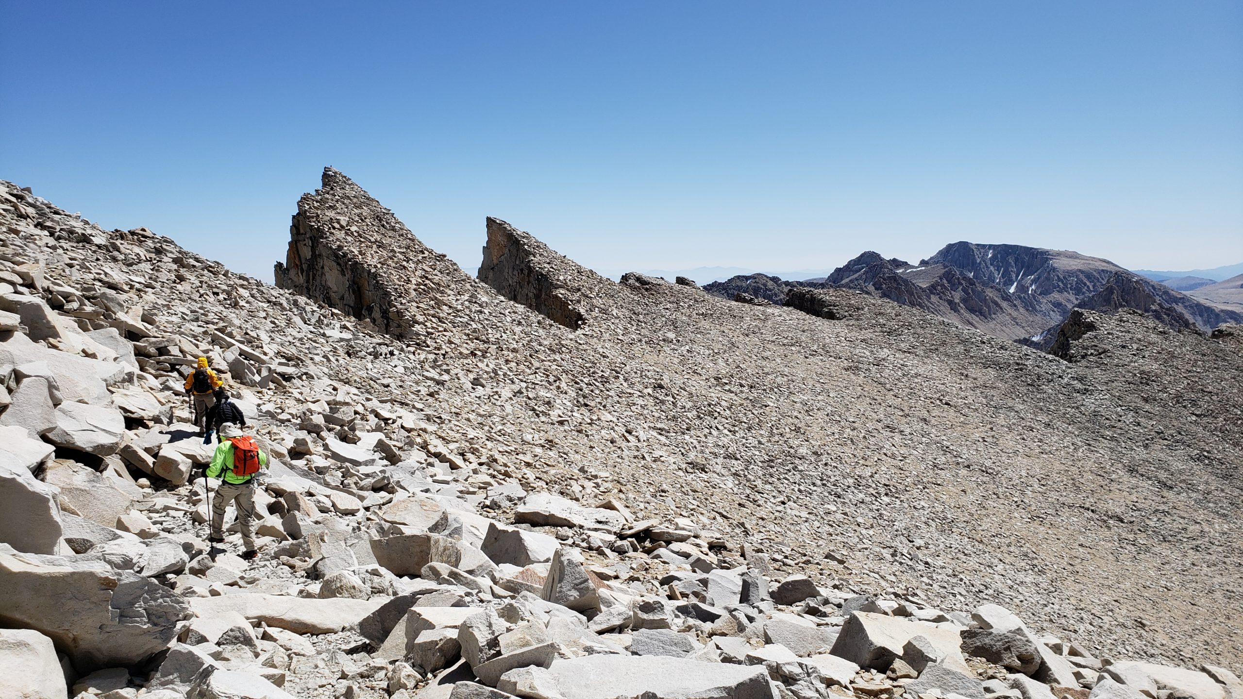
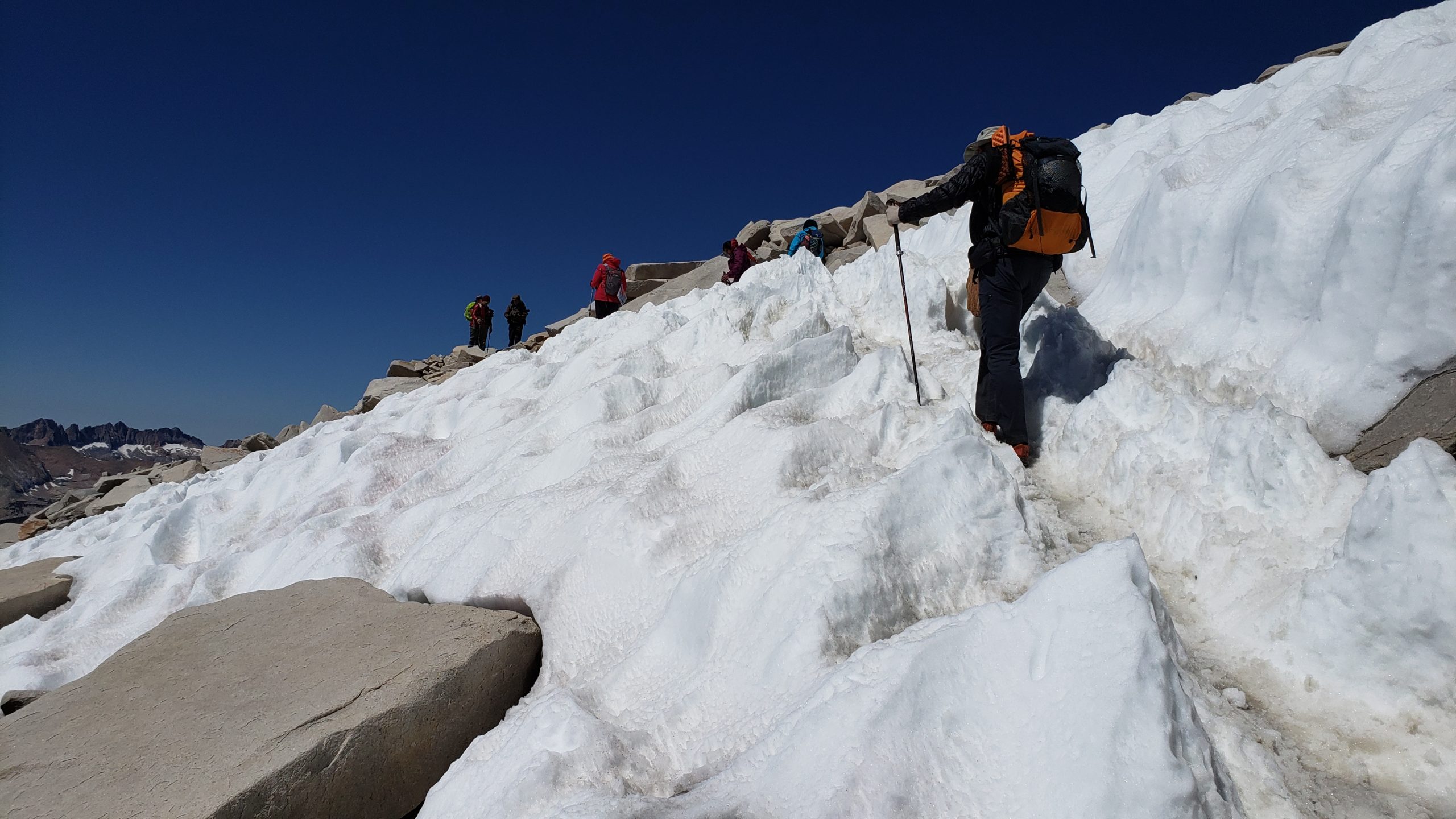
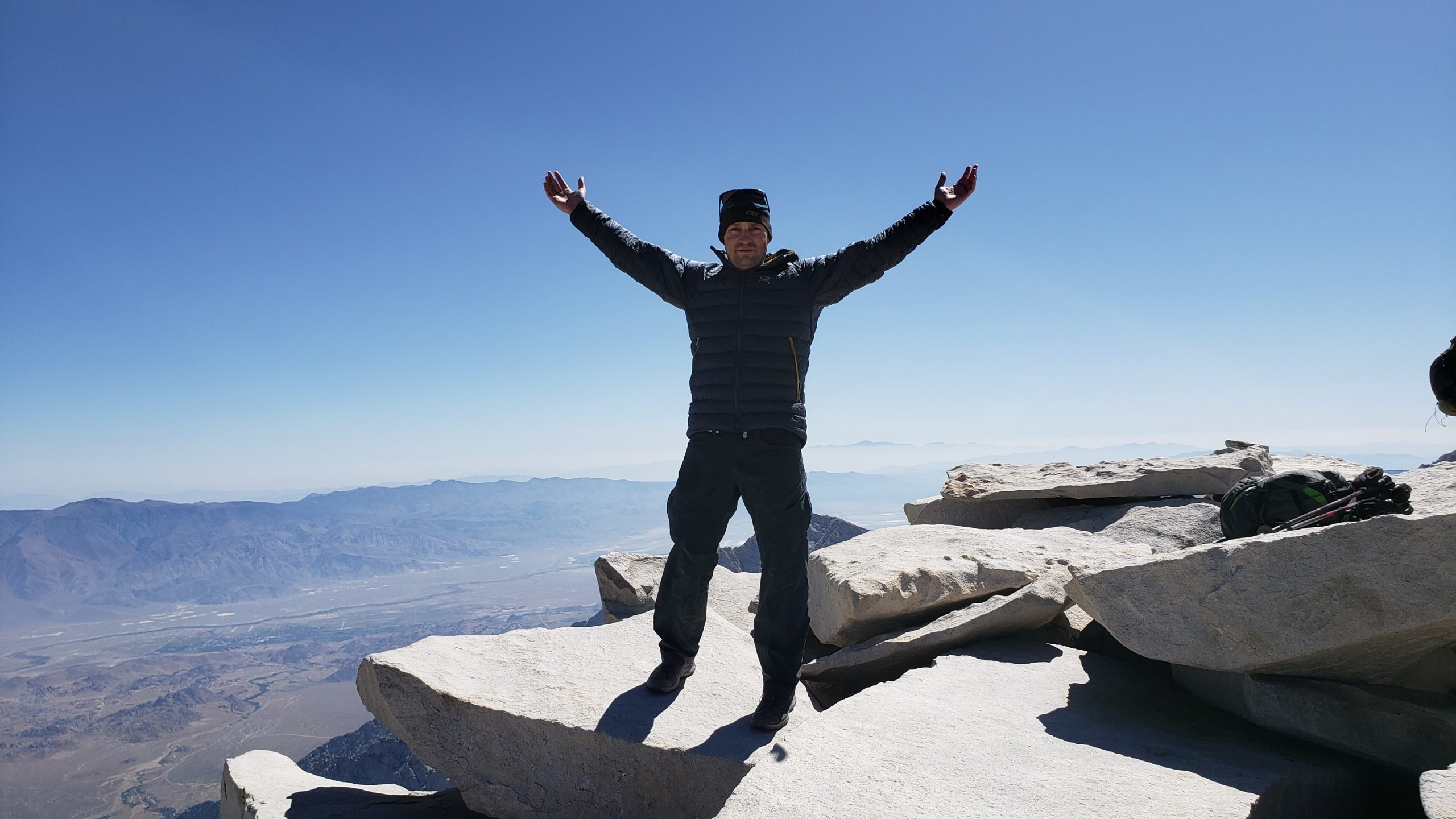
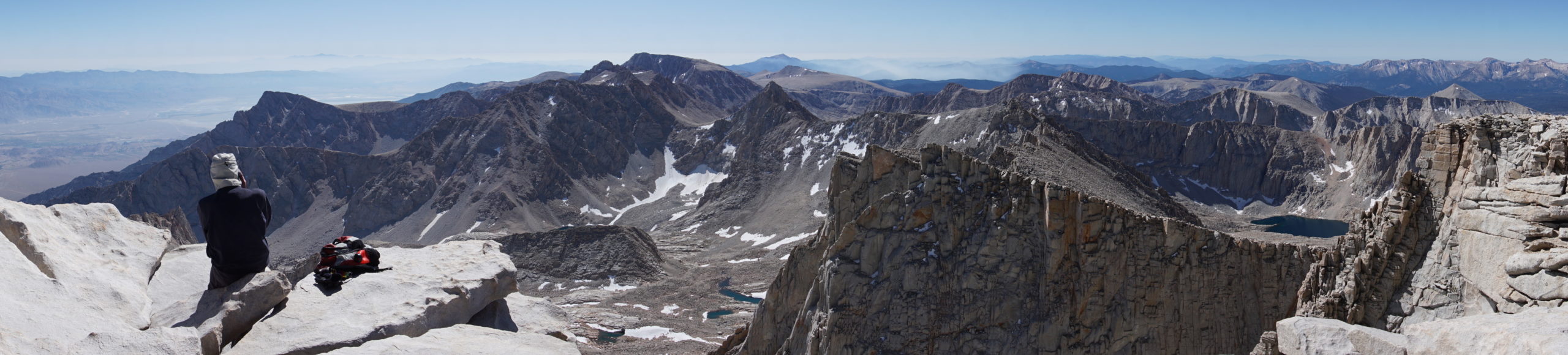
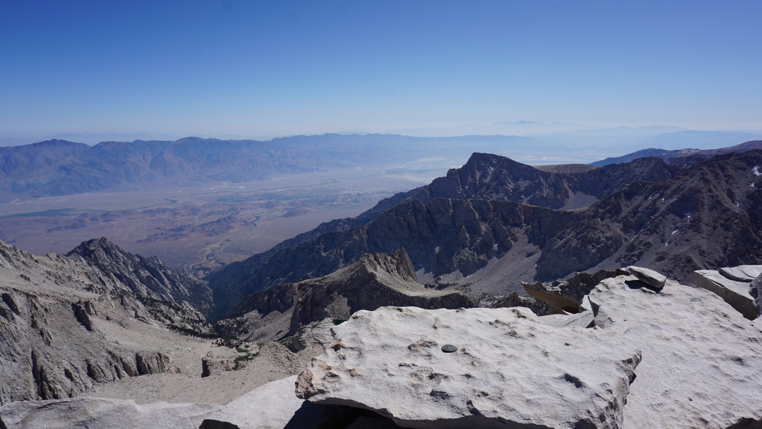
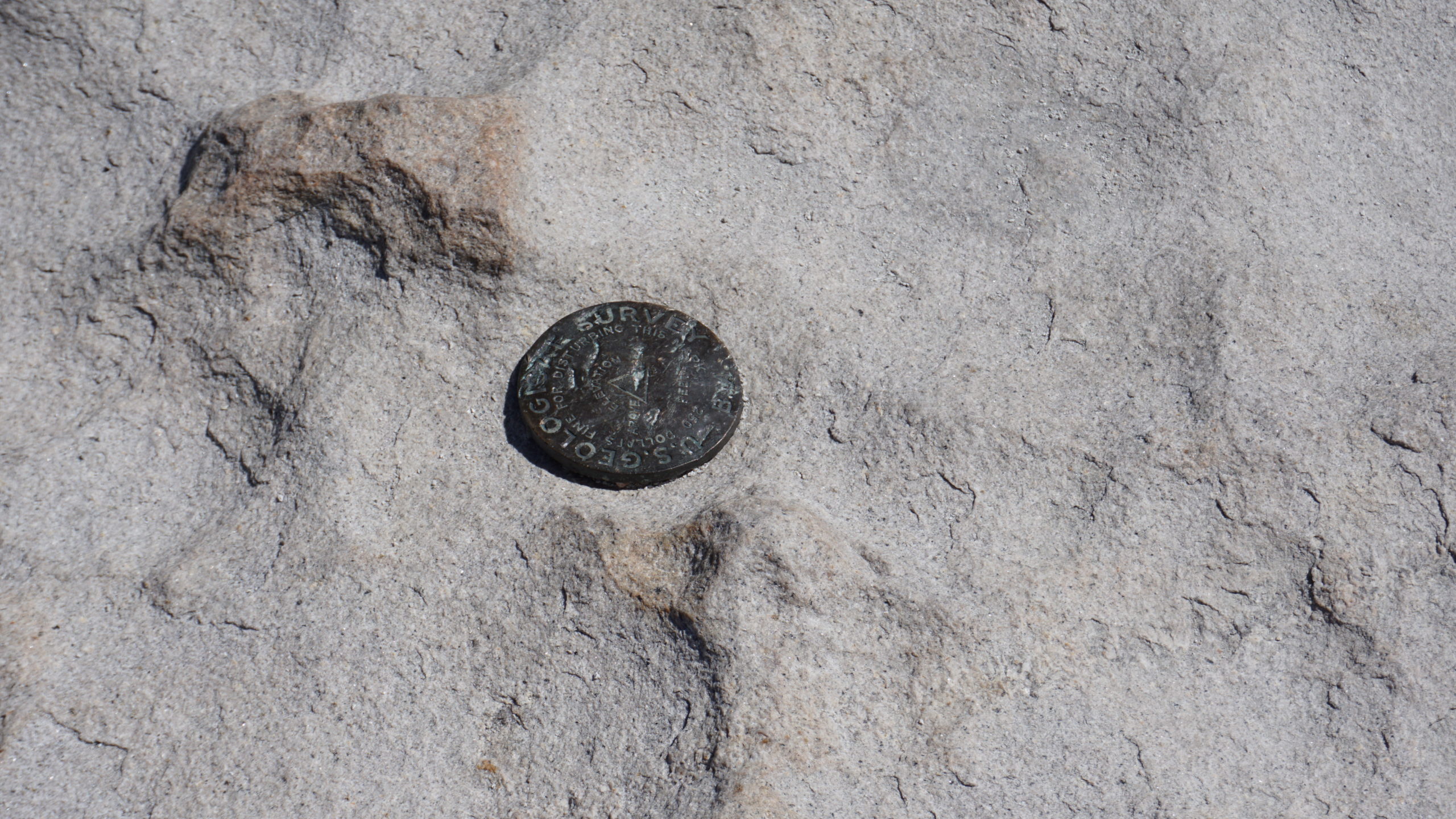
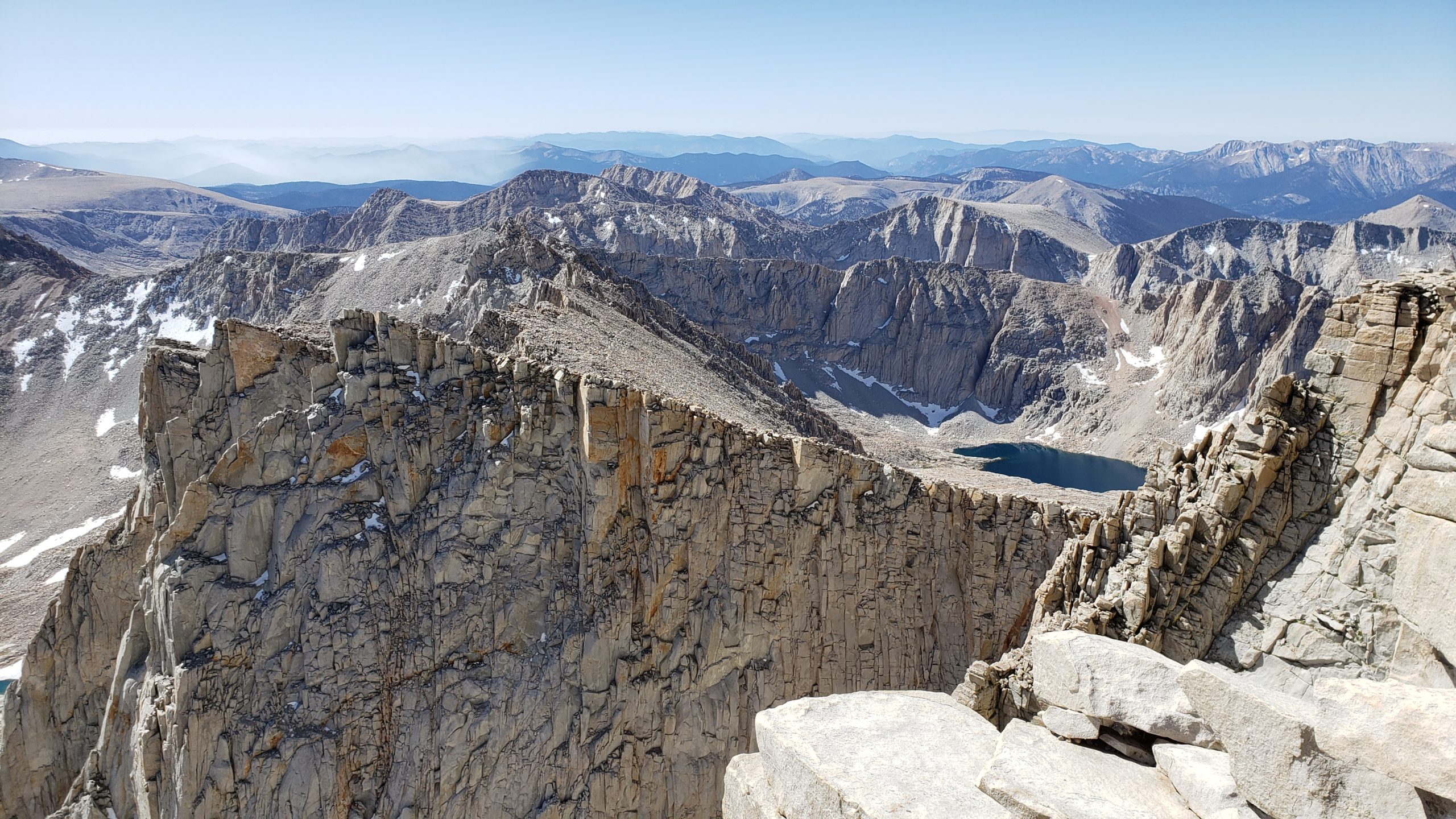
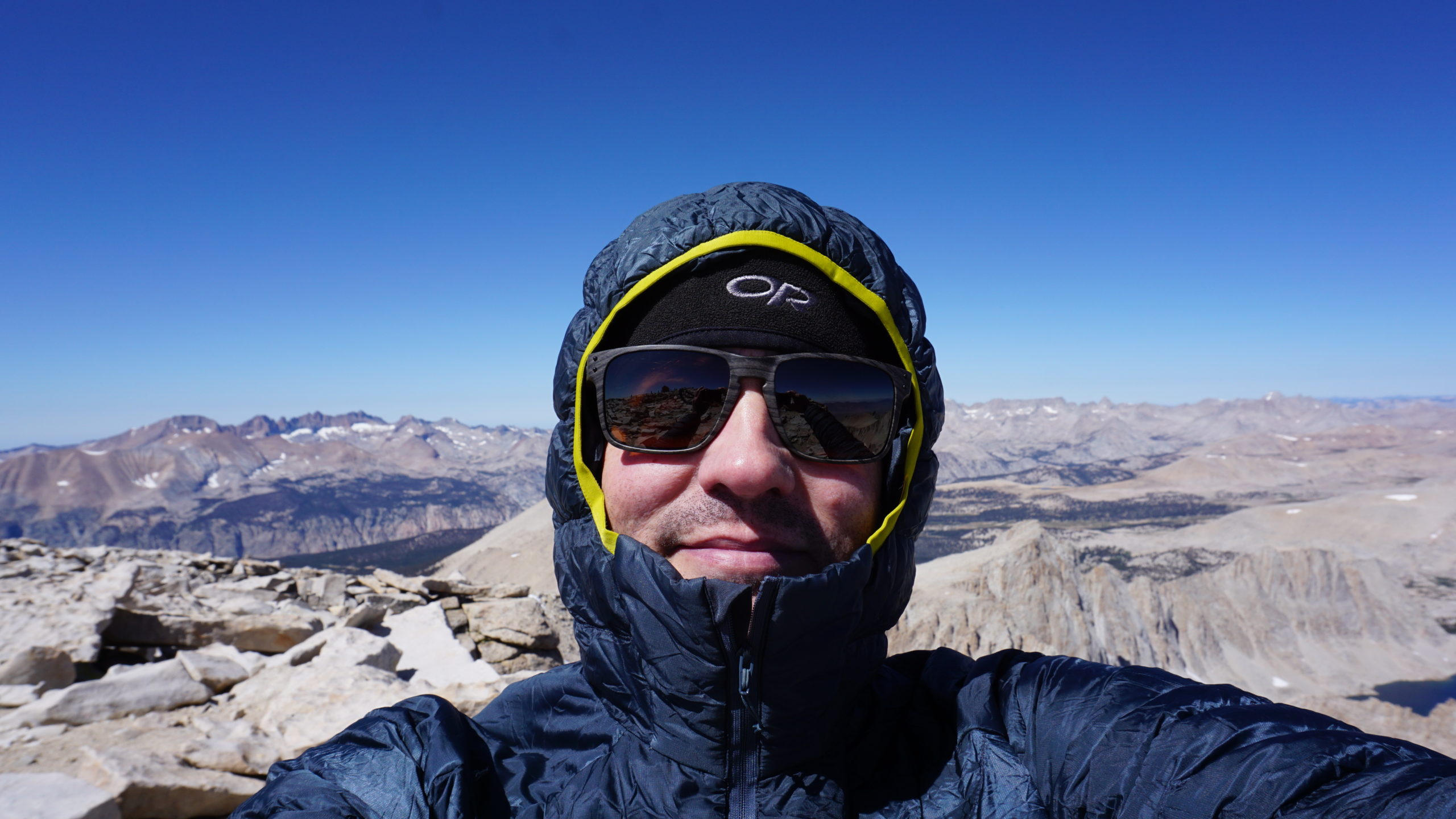
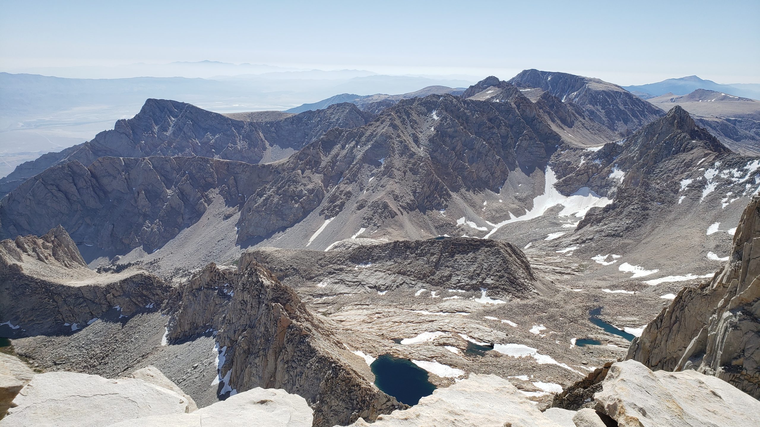
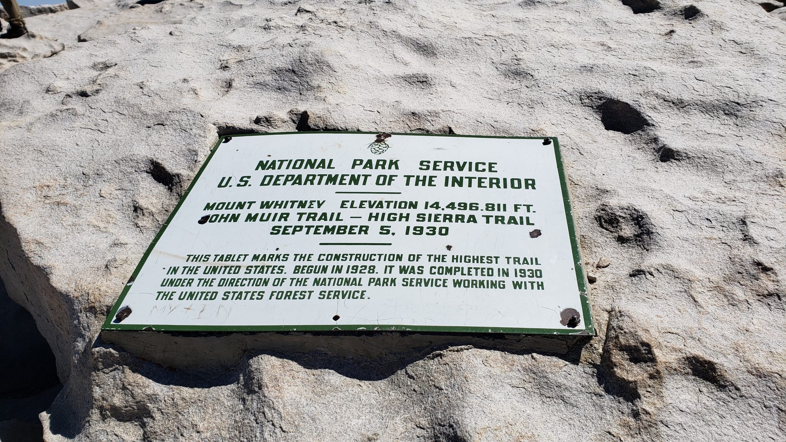
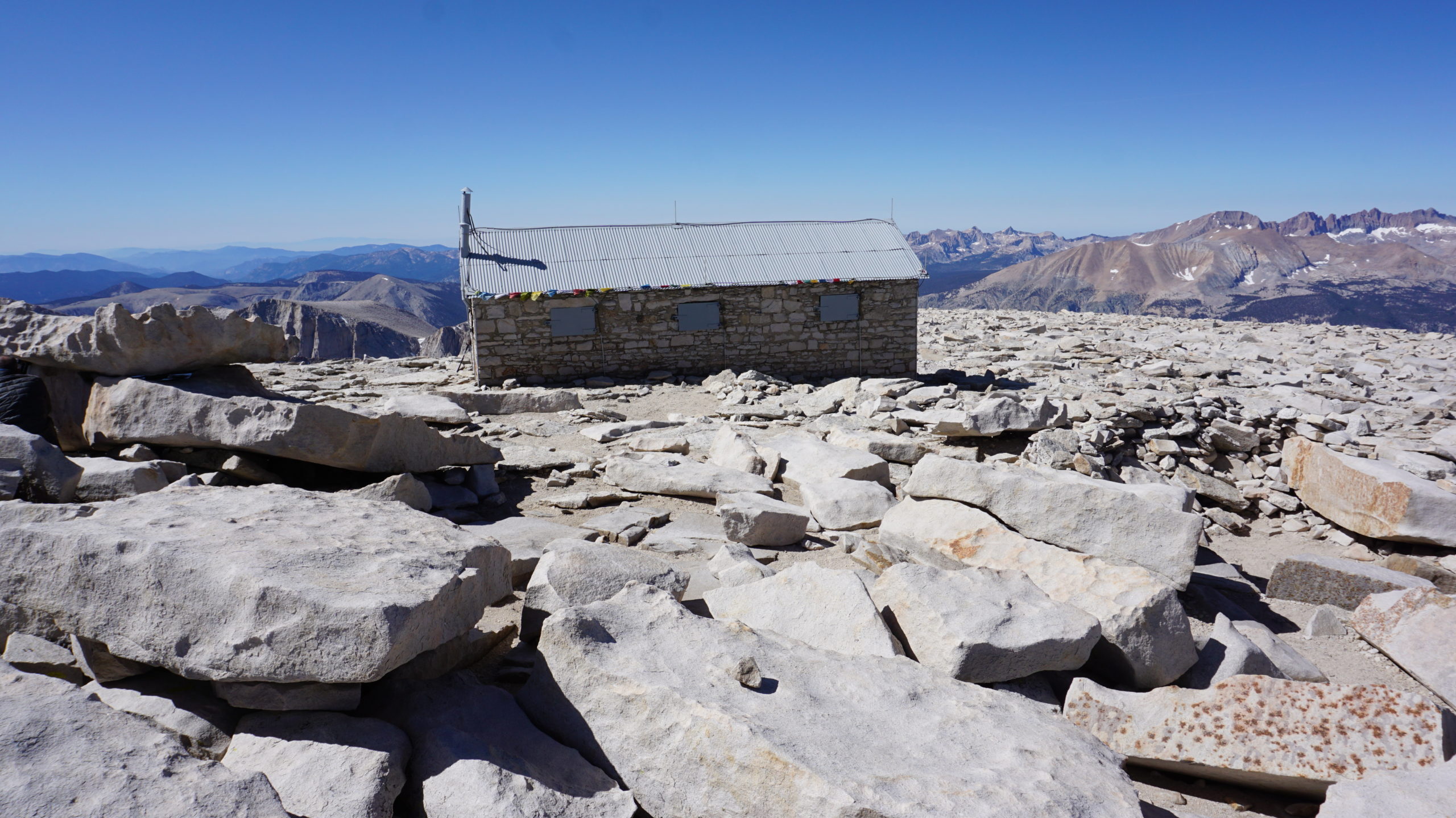
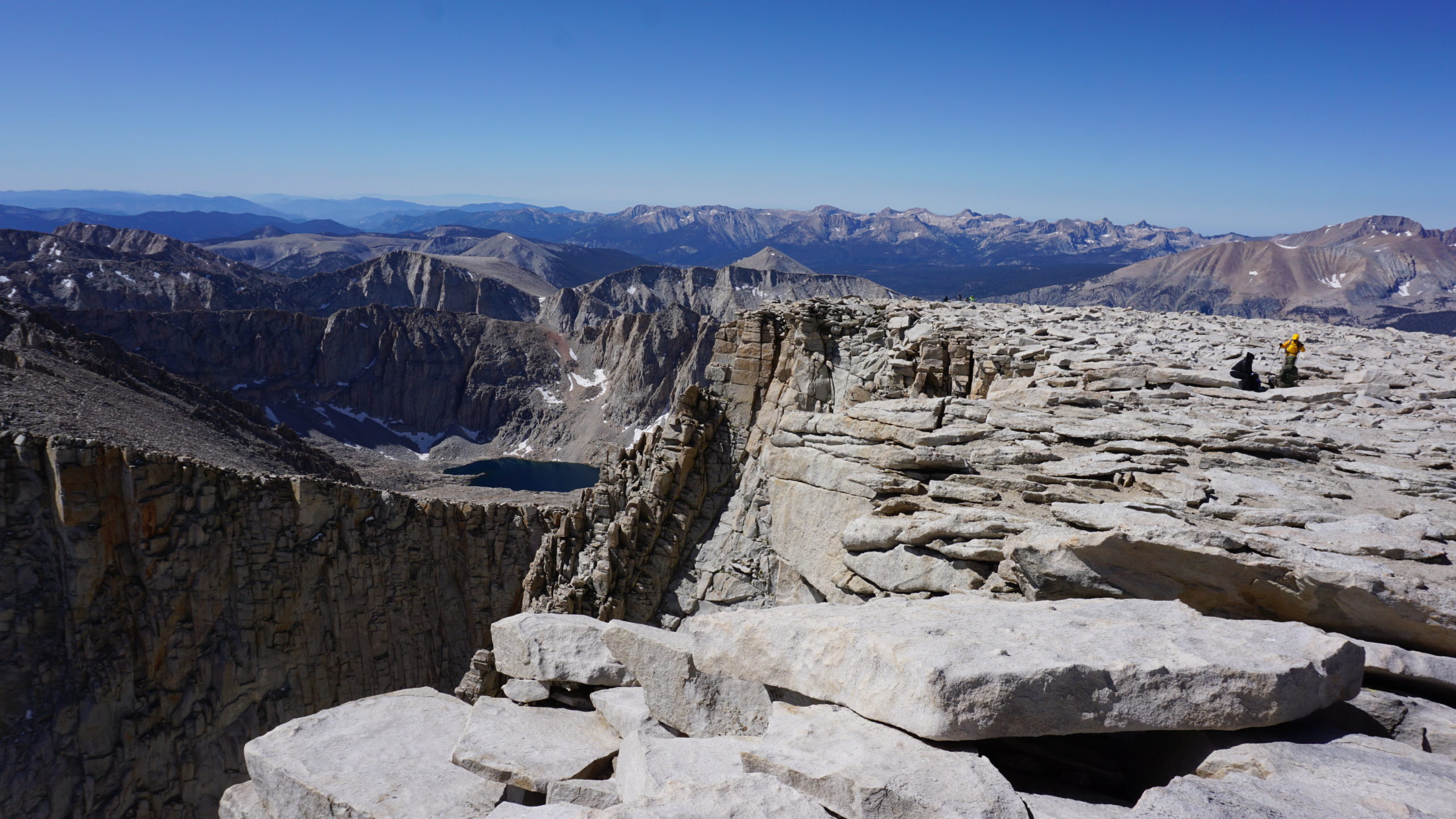
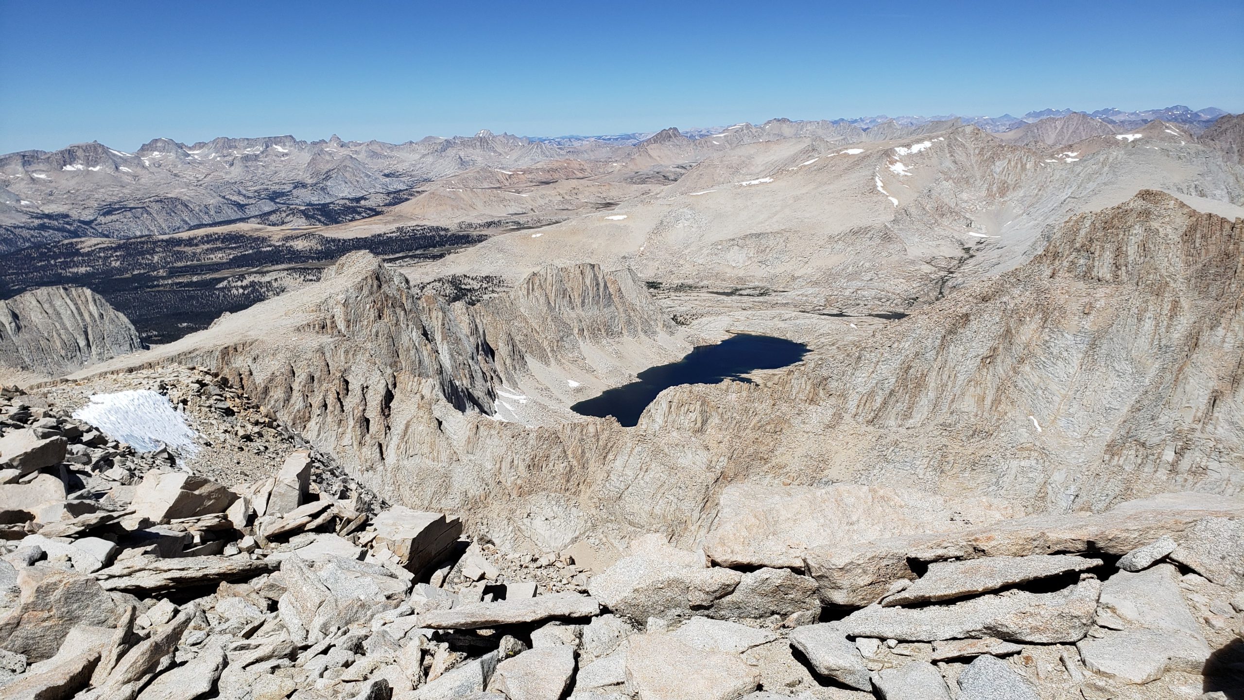
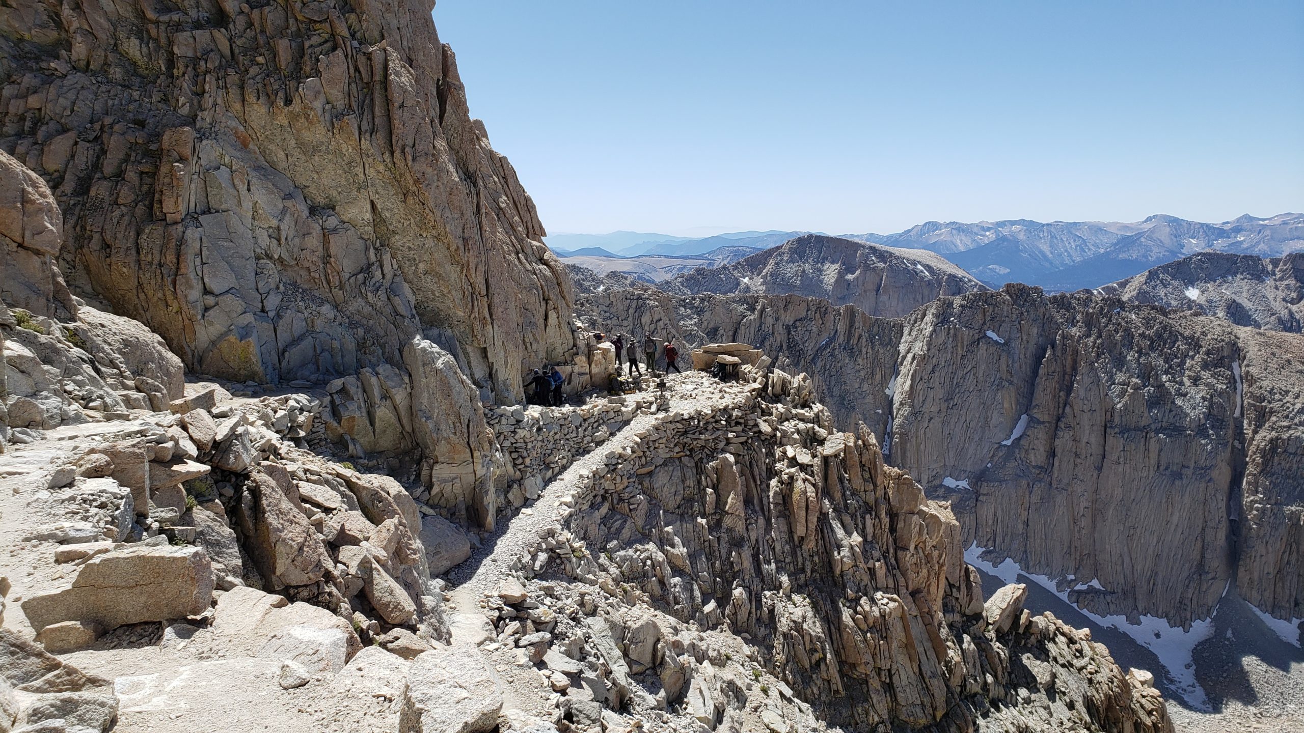
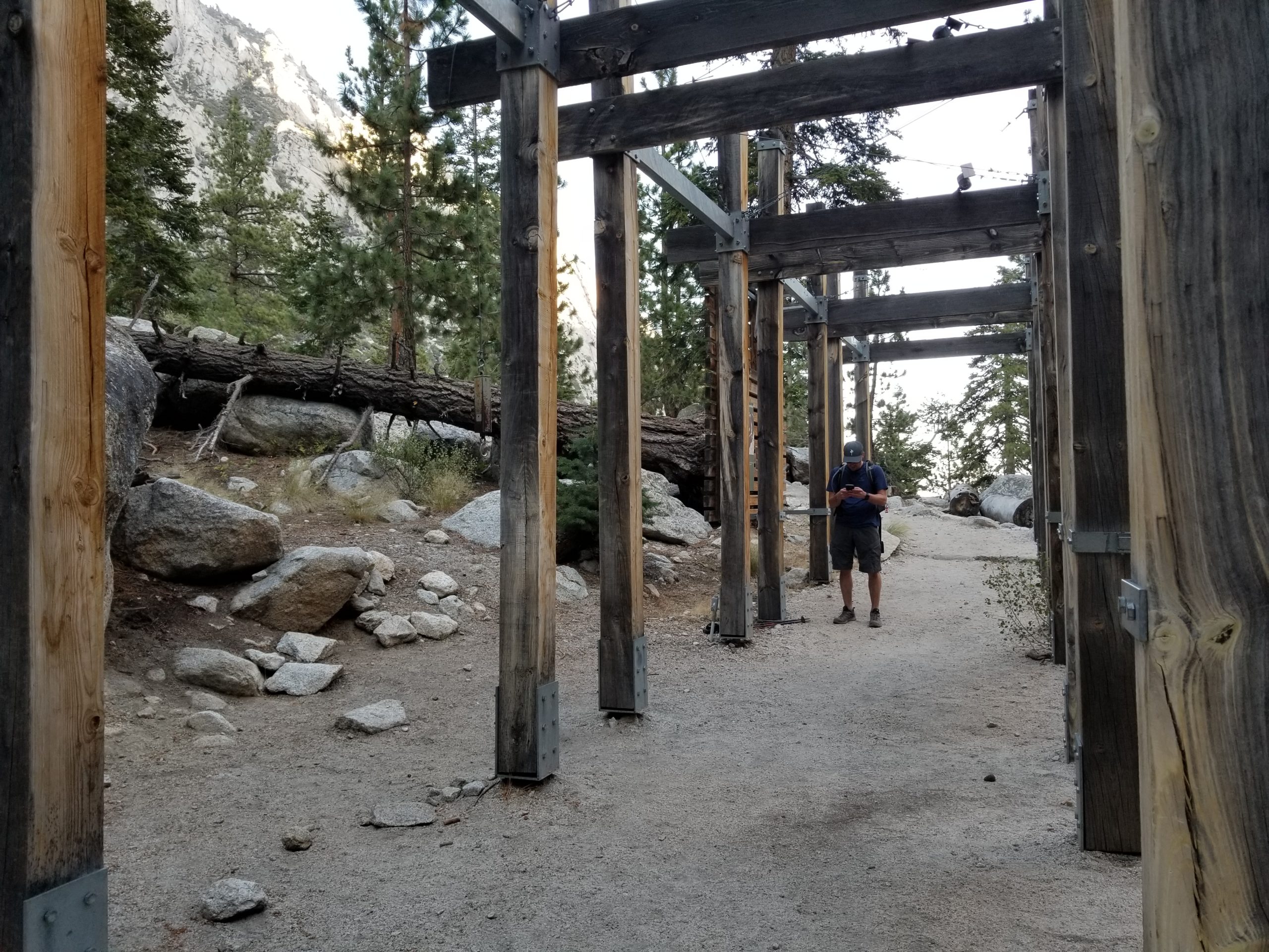
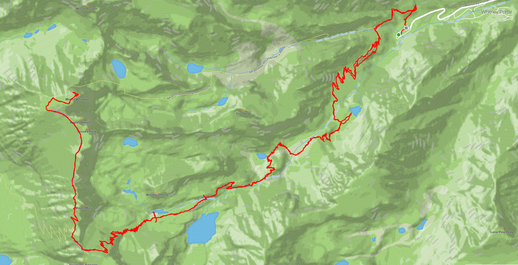
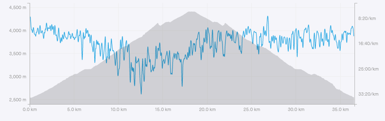
The sun finally starts to come up as I make my way up the valley. If you look carefully you can still see some white dots, those are the headlamps of people behind me.Finally, a bit of sun and I can turn my headlamp off. The temperature starts to warm up a little bit but that won’t last very long. As I gain altitude, it will cool down considerably.I finally get a look at what lays ahead of me. It is around 7am and I have already been hiking for about 3 hours. A little about this hike…. It is going to be 37km of hiking with an elevation gain of nearly 7000 feet. The summit is at 14,505’ in elevation.From here on, I will post pictures I actually took on the way down as the lighting was better. If you look closely you can see a person walking on the trail in front of me to get a feel for the scale of this place, it is huge! Once you pass 11,000 feet in altitude, trees stop growing. Eventually, I make it to the last campground. This is where most people would stop and spend the night, making their summit attempt in the morning. I on the other hand, just keep on going as I didn’t want to carry a heavy backpack. This camp is at 12,000 feet in elevation. Due to not taking time to acclimatize, I intentionally start to slow my ascent now. Altitude Mountain Sickness is serious and can kill you (more on AMS later). I have been taking 400mG of Ibuprofen every 4 hours to try to lessen the effects the altitude has on my body. After leaving the campground this is what I am facing. The route will go up the left-hand side of this face and then traverse across it left to right. “Only” 8km and many thousands of feet of climbing left to go. Which normally wouldn’t be too bad, but hiking since 4am and being above 12,000 feet in altitude this feels like a daunting task. Not wanting to ever get up at 3am again, I decide I must keep going.The next section is referred to as the 99 switchbacks. You can guess how it got its name. It is around this point that the altitude really starts to take a toll. I try to do simple math in my head to figure out when to take my next Ibuprofen and it takes numerous attempts before I can figure it out (1 every 4 hours). My brain isn’t getting enough oxygen at this elevation to perform as well as it normally would. If I was in a commercial airliner at this elevation without pressurization, the little masks would have dropped by now. It is kind of hard to make it out in this picture but these are just a few of the 99 switchbacks. I passed a guy on these switchbacks. He was stopped, panting on the side of the trail trying to catch his breath. We had this conversation: Me: Hi! Him: I’m fine, thank you for asking Me: ….(confused look) Him: You didn’t ask me anything did you? This thin air is really messing with my head. Of course, I act all macho like the seasoned mountain man I am, pretending the thin air doesn’t bother me at all. In reality, I can no longer add up 4 hours of time without multiple attempts. At a particularly dicey spot, the parks service has installed cables you can hang onto. I’m told it is almost always icy here and it certainly was when I passed through. Notice the bent over posts? Those are damaged from giant boulders that occasionally tumble down through here. Not the sort of place you want to stop at. The small green patch below is the campground from a couple pictures previous.Panorama as I near the end of the 99 switchbacks. The summit is not what appears to be the high point in this photo but is the peak on the far right of the photo. Still a long way to go.This spot on the trail is called the trail crest. I’m told this is where most people give up and turn around. The altitude of 13,600’ combined with the view of how far away the summit still is after climbing 99 switchbacks is a recipe for defeat (the switchbacks alone are 3.5Km long). Having spent an entire summer training for this, I certainly feel the altitude but am in good enough shape to carry on.From here, the traverse begins across a series of peaks called the needles. At this altitude, there is roughly half as much oxygen as there would be at sea level. You feel a bit dizzy and every step takes far more effort than it normally would. My muscles feel great and want to motor on as fast as possible. My lungs and brain on the other hand think this is a stupid idea.In places, the trail is a tiny bit exposed. Compared to the Rockies, this isn’t bad at all, but when you are feeling the effects of 13,000 feet of elevation, you need to be extra careful. It was completely disheartening when the trail started to go downhill for a while. All that hard-earned elevation lost and will have to make it up again.Take a few steps, stop, breath, repeat.The summit is still a long way off. As much as I often joke about Altitude Mountain Sickness (AMS), it is very serious and does kill people on this trail. Most guides suggest spending at least 5 days acclimatizing or 3 on the accelerated plan for climbing Whitney. Other than a short hike the day before, I didn’t do any acclimatizing. I pay very close attention to how I am feeling so that I recognize when I am in serious trouble and have to quickly start descending.Since I haven’t done any sort of acclimatization, the altitude starts to take a bit of a toll on me. I’m sure if I had acclimatized this climb would be no problem at all. I slow the pace down a little bit, try to stay hydrated and eat food but you really don’t feel like eating or drinking anymore.As we get higher snow starts to appear. The narrow crossing causes people to bunch up. The parks service limits how many people can climb Whitney each day to limit line ups and over crowding. You can learn about my journey to get a permit here:http://www.tripbagger.com/2019/09/10/shawn-bags-winning-the-lottery/On the Summit!!!!The views up here are not bad at all!Looking back down the valley where my day started many hours ago. Notice the round thing on the rock in the lower part of this picture?It is the survey marker that marks the top of the mountain. 14,505 feet in elevation or 4421 meters. I have hiked up nearly 7000 feet in elevation gain today.More views from the highest point in the contiguous US. The clouds in the distance are actually smoke from a large forest fire.You better believe the traditional summit selfie makes an appearance! And yes, it is that cold up here. Not sure what the temperature was but certainly below zero judging by my frozen water.At sea level, the air around you is made up of about 20% oxygen. At this altitude, it is closer to 12%. Although I did find after hanging out on the summit for about an hour I became much more accustom to the thin air. You may have noticed the official sign has the summit stated a bit lower than my claim of 14,505’. The reason for this is simply that we have gotten better at measuring mountains and have determined the height of Whitney with more accuracy over the years.There is a shelter on the summit. Built by the Smithsonian institute in 1909. One of the risks I haven’t mentioned yet is lightning. This area is frequently subjected to lightning storms. This was one of the main reasons for starting so early in the morning. To get off the summit before any afternoon thunderstorms pop up. There is a warning on the building: “EXTREME DANGER FROM LIGHTING. Building will not protect you from lighting. Go to a lower elevation immediately.”There is also a warning on the building that search and rescue actions are conducted on a discretionary basis only. “These parks expect visitors to exhibit a high degree of self reliance and responsibility for their own safety, commensurate with the difficulty of their chosen activity. The higher risk the activity, the more you need to be prepared for dealing with emergency situations. Be aware that help may be several days out.”Mount Whitney is part of the snowy sawtooth range in the Sierra Nevada mountains. At 650km long, this range is larger than the Swiss, French and Italian alps combined!!! After taking in the views and catching my breath, it is time for the long journey back down. The top is only halfway after all.The fun part about coming back down the mountain was that it was mostly all new to me. Having hiked up in complete darkness, it was breathtaking to be able to see the stunning scenery on the way back down.
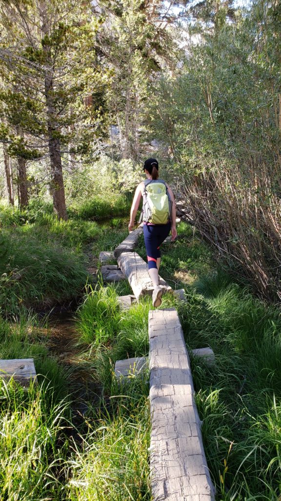
Remember the earlier picture of these logs in the dark? They look much nicer in daylight. Sian had walked a couple kilometers up the trail and met me as I was making my way back down.
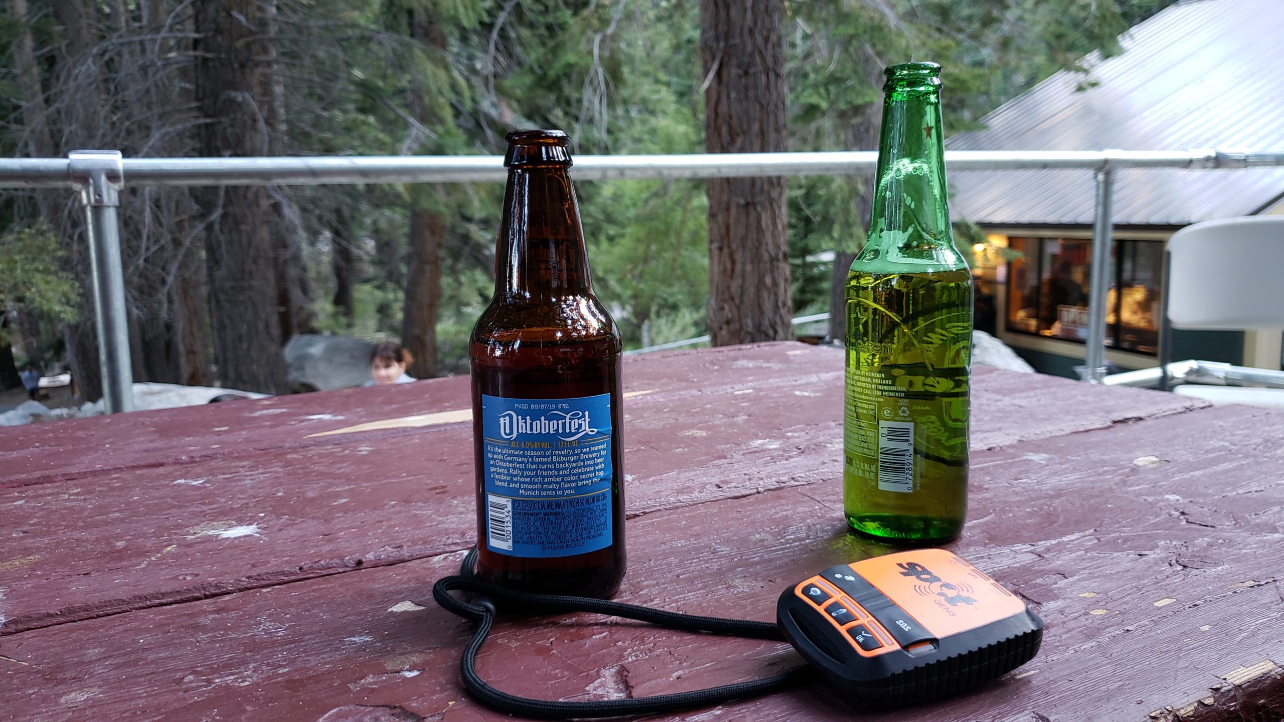
The very end of the trail. Sian likes to make fun of me. Rather than celebrate my success with a victorious pose, I had to check my GPS to see how far I had gone. 36.59 km. Elapsed time of 13hours and 28 minutes (10 hours moving time). Total elevation gained of 7000 feet. Sian might be right; I probably should have done a victory pose.Of course, you have to finish the day with a beer at the Whitney portal store. I’ve never been so excited to have a beer in my life.
Excellent pictures and commentary! A well earned once-in-a-lifetime achievement! You have now raised the bar very high for youeself … I know … challenge accepted!
Christine
· April 27, 2020 at 4:53 am
Bloody nora, never realized what u went thru. My magnet now has a special place on my fridge. Chris
[…] to protect the giant trees from logging. John Muir also pioneered the route up Mount Whitney: http://www.tripbagger.com/2019/09/11/shawn-bags-mount-whitney/ As I mentioned earlier, if your willing to walk even just a few minutes from the parking lot, you […]
[…] in that direction. However, its summit is well over 1 mile higher than our current elevation.http://www.tripbagger.com/2019/09/11/shawn-bags-mount-whitney/ View in the other direction. Note the winding road on the right side of the photo. Sian and her […]
[…] Whitney, it is tradition to have a beer here. Next stop, the summit of Mount Whitney (hopefully).https://www.tripbagger.com/2019/09/11/shawn-bags-mount-whitney/ Categories: HikesPeak BaggingTravelUS Peak BaggingUS TravelUSA Hikes Tags: Inter-agency Vistor […]
[…] again. That mountain in the middle is Mount Whitney, the highest mountain in the lower 48 states.https://www.tripbagger.com/2019/09/11/shawn-bags-mount-whitney/ Despite a mobius strip only having one side, the mobius arch does indeed, have two sides. Another […]
7 Comments
Dad · April 26, 2020 at 6:53 pm
Excellent pictures and commentary! A well earned once-in-a-lifetime achievement! You have now raised the bar very high for youeself … I know … challenge accepted!
Christine · April 27, 2020 at 4:53 am
Bloody nora, never realized what u went thru. My magnet now has a special place on my fridge. Chris
Shawn Bags Sequoia National Park – Trip Bagger · May 18, 2020 at 9:56 pm
[…] to protect the giant trees from logging. John Muir also pioneered the route up Mount Whitney: http://www.tripbagger.com/2019/09/11/shawn-bags-mount-whitney/ As I mentioned earlier, if your willing to walk even just a few minutes from the parking lot, you […]
Shawn Bags Moro Rock – Trip Bagger · May 25, 2020 at 3:37 am
[…] in that direction. However, its summit is well over 1 mile higher than our current elevation.http://www.tripbagger.com/2019/09/11/shawn-bags-mount-whitney/ View in the other direction. Note the winding road on the right side of the photo. Sian and her […]
Shawn Bags Winning the Lottery - Trip Bagger · March 26, 2022 at 7:14 pm
[…] Whitney, it is tradition to have a beer here. Next stop, the summit of Mount Whitney (hopefully).https://www.tripbagger.com/2019/09/11/shawn-bags-mount-whitney/ Categories: HikesPeak BaggingTravelUS Peak BaggingUS TravelUSA Hikes Tags: Inter-agency Vistor […]
Shawn Bags the Alabama Hills - Trip Bagger · March 26, 2022 at 7:20 pm
[…] again. That mountain in the middle is Mount Whitney, the highest mountain in the lower 48 states.https://www.tripbagger.com/2019/09/11/shawn-bags-mount-whitney/ Despite a mobius strip only having one side, the mobius arch does indeed, have two sides. Another […]
Shawn Bags a Brand New Low – Badwater Basin - Trip Bagger · April 10, 2022 at 3:52 pm
[…] properly as altitude sickness is a serious concern….. and I know just the idiot for this job. https://www.tripbagger.com/2019/09/11/shawn-bags-mount-whitney/ Categories: TravelUS Travel Tags: Badwater BasinCaliforniaDeath […]