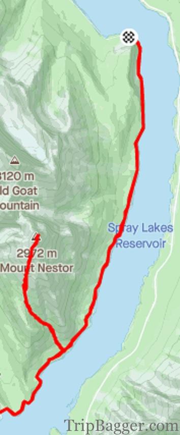
NOTE: The gravel road you take to get to mount Nestor is a choke point for animals traveling down the valley. Avoiding this area will give the locals more space (I learnt this after the fact).
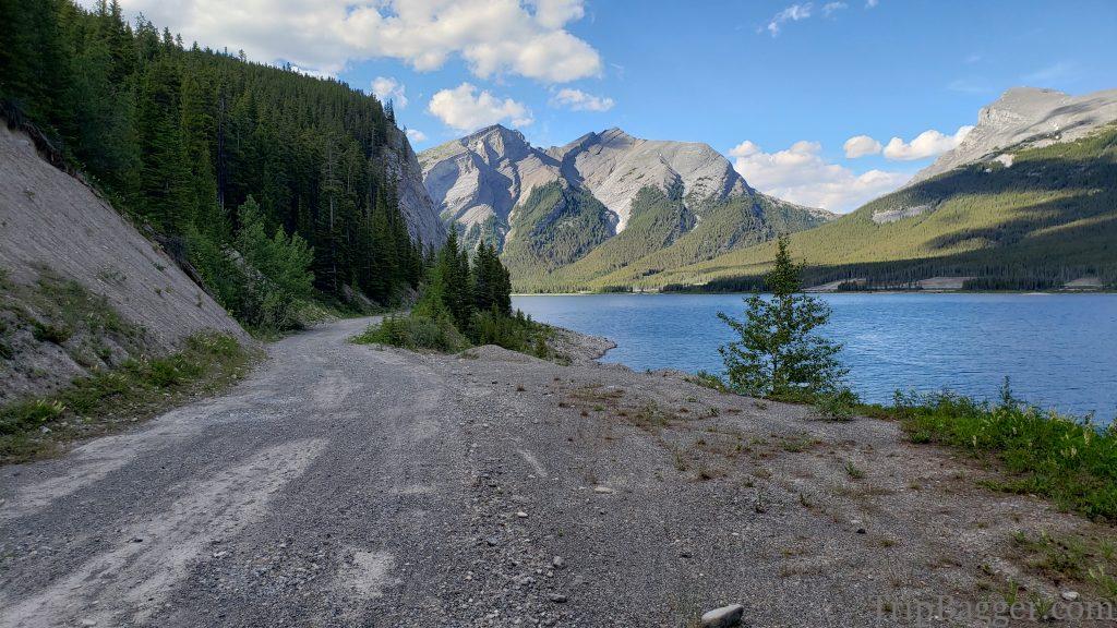
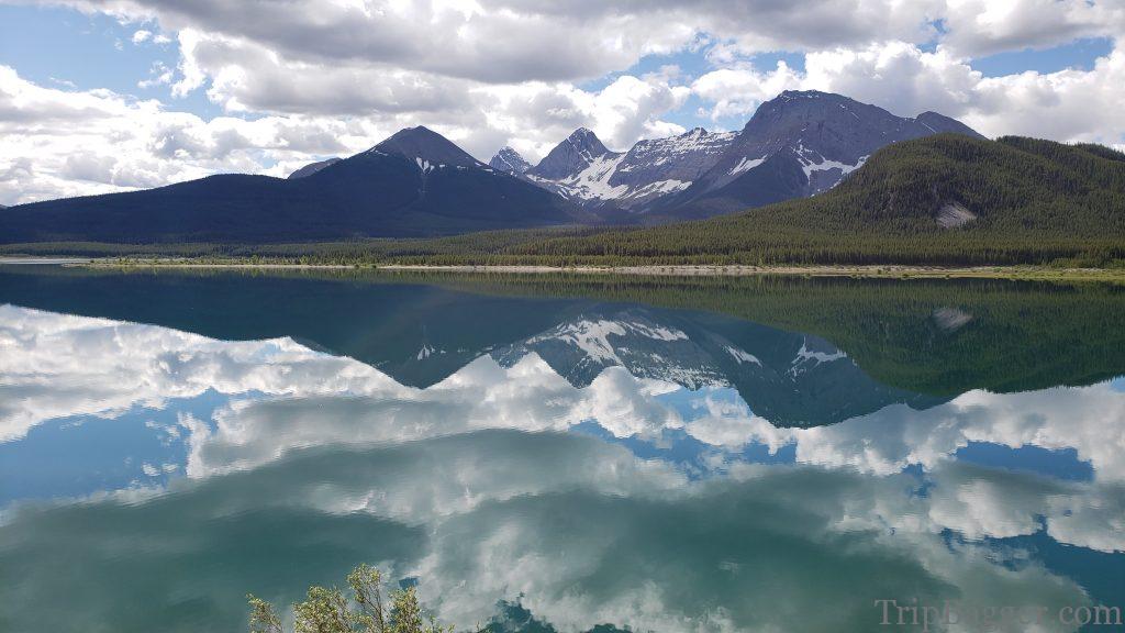
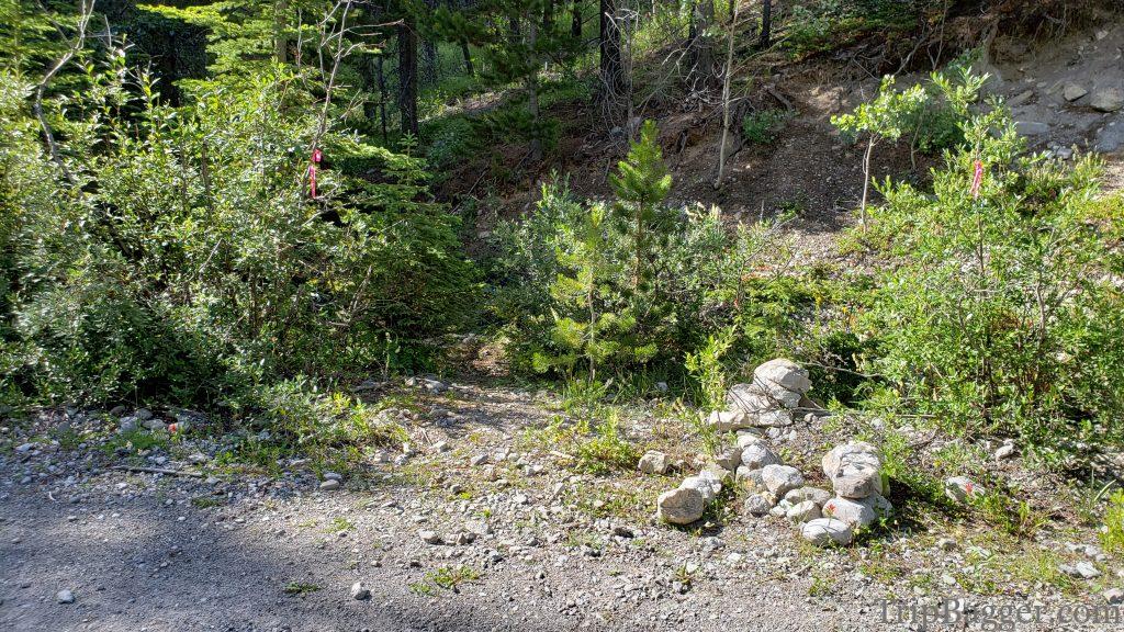
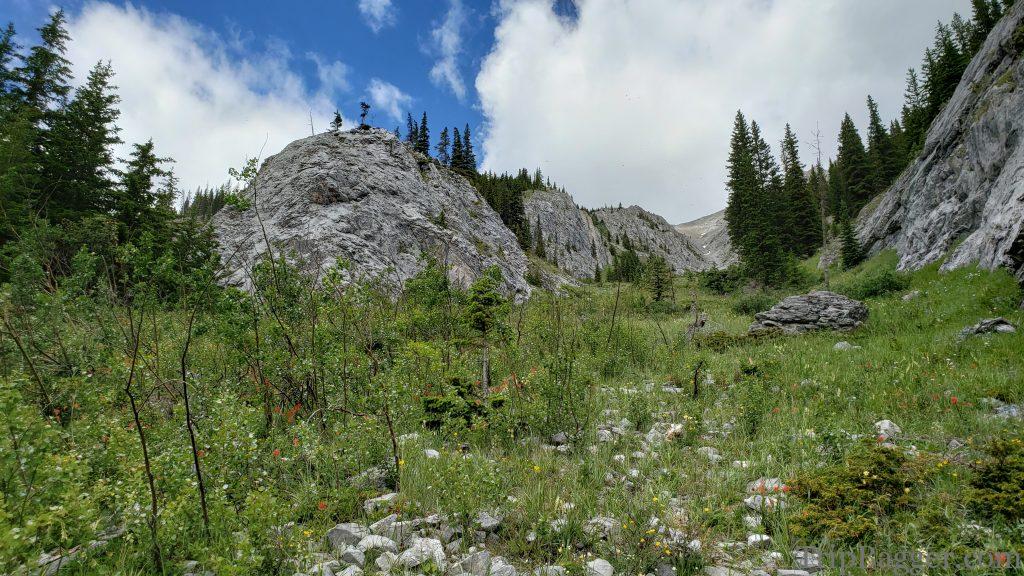
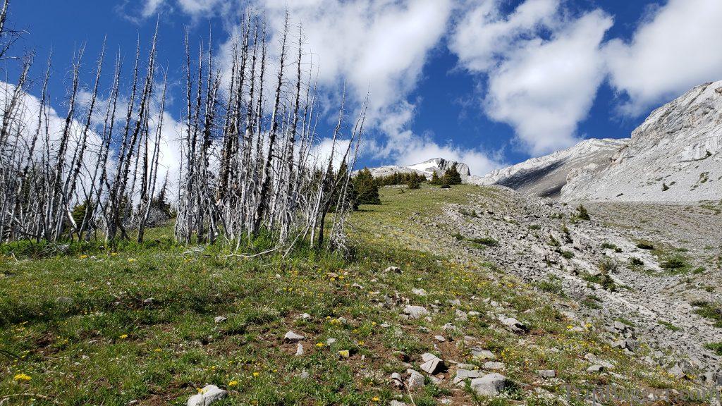
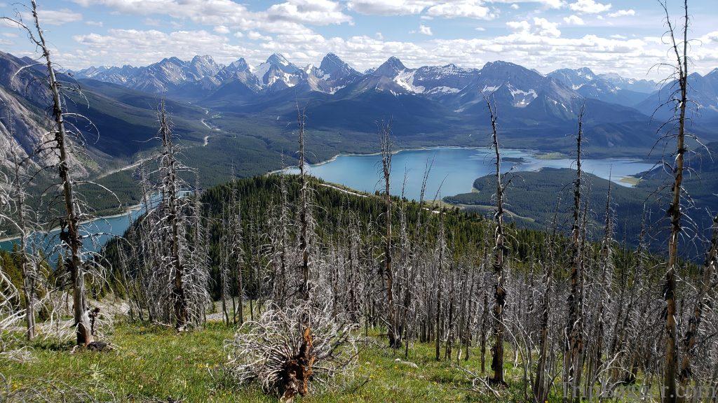
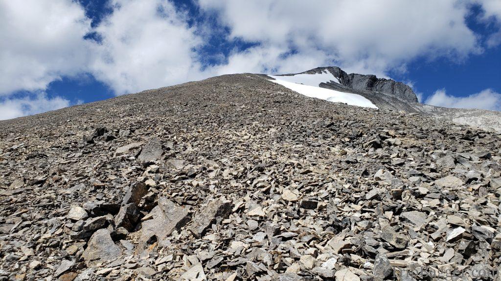
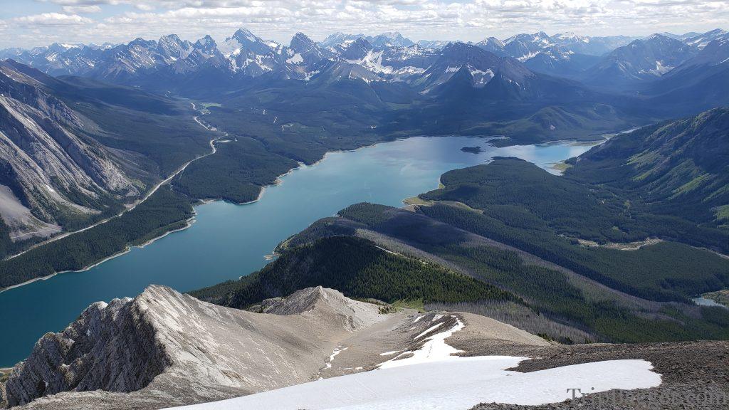
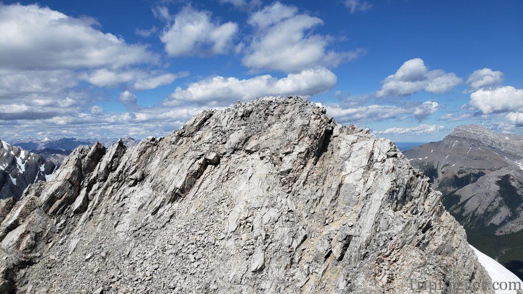
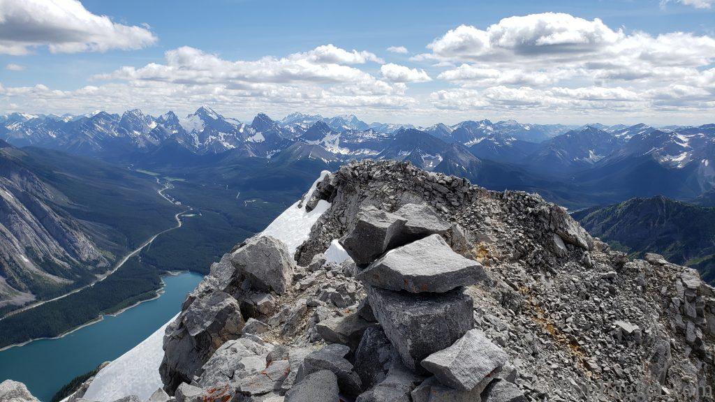
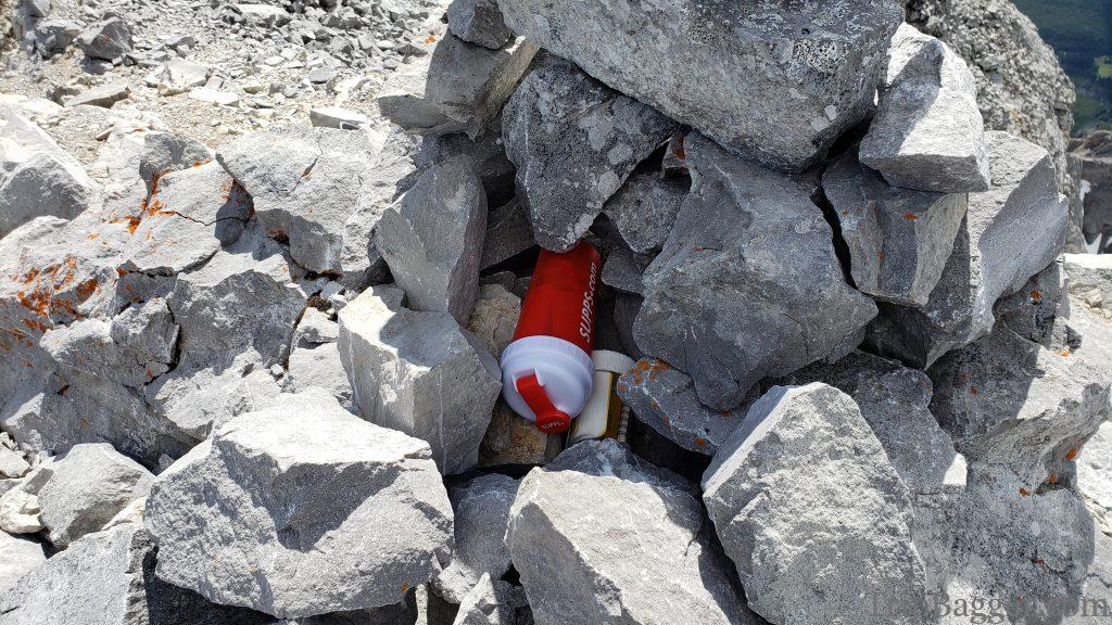
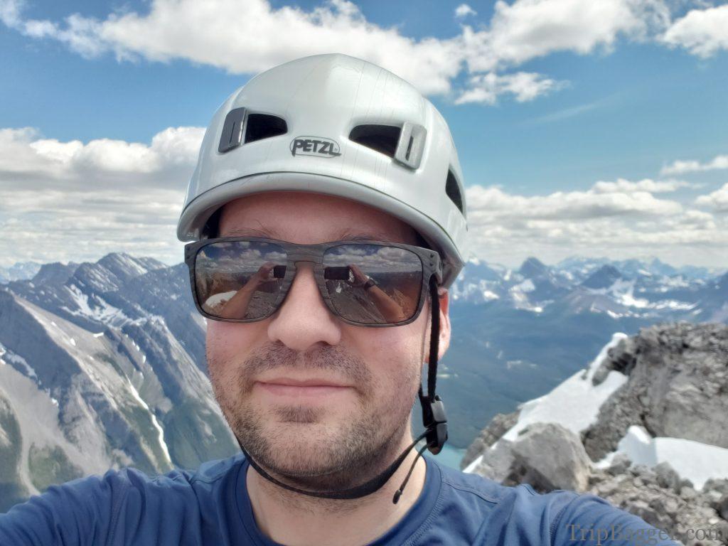
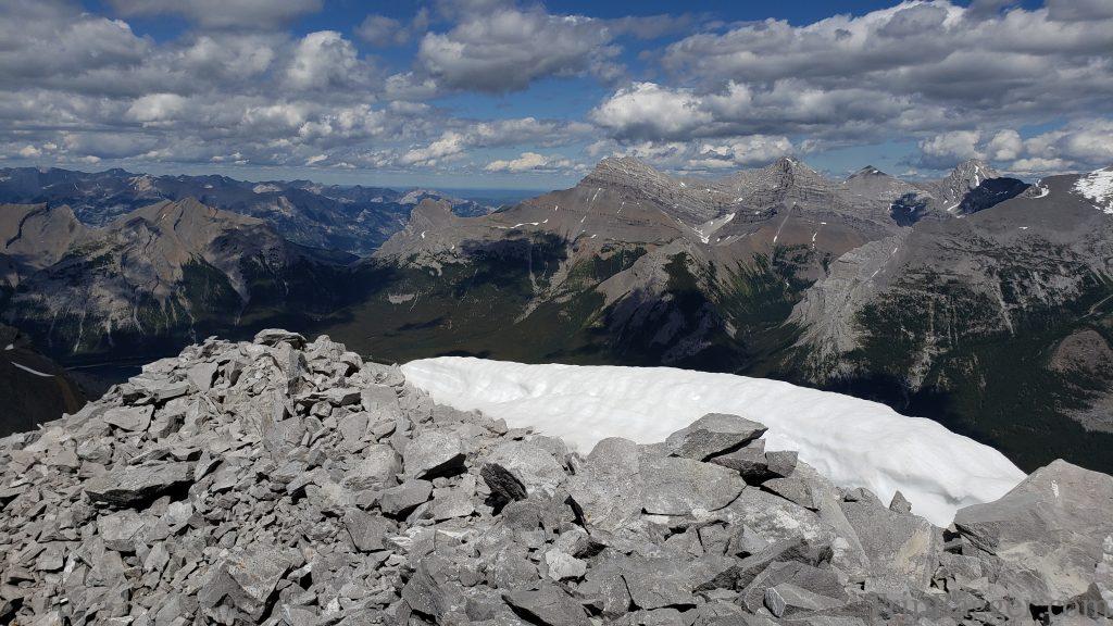
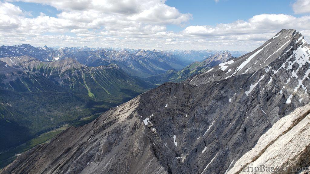
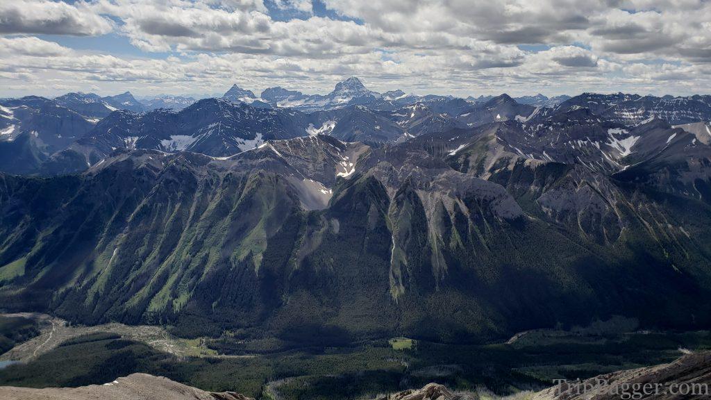
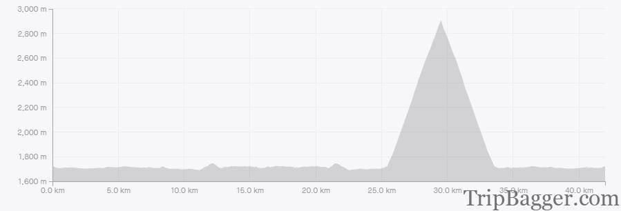
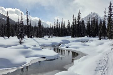
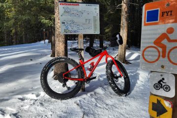
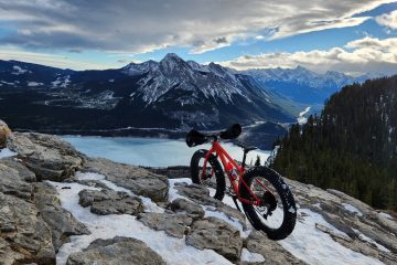
The day starts with a nice easy bike ride along the Spray Lakes. The guidebook indicates you ride 13.4Km from the gate to a slight rise and S curve in the road. At 13.4Km there is a slight rise and S curve. What I didn’t realize is that there are two gates. The 13.4Km distance is from the first gate. The end result is that I had biked far further than I should have. On the plus side, I got to enjoy this view of calm spray lakes in the morning. I turned around and started heading back to find the trail. I measured the distance on the way out, the trail is actually 8.8Km from the gate that is South of the campground.And here is the trail for the ascent up Nestor. I must have ridden right past this initially. In all fairness, who would have noticed the bright pink survey tape, and giant letter “N” made out of rocks to tell you this is the way to mount Nestor.After heading uphill for a while, I arrived at this junction. I went left, but I believe you can go right or scramble up the middle. Due to missing the turn on the bike, I was short on time and picked what I figured would be the fastest way.Looking back down the avalanche gulley I was heading up. This area was carpeted in alpine flowers and I’m sure would make prime bear habitat. I made a bunch of noise to let them know I was visiting.After leaving the avalanche gulley I hung a right and started the ascent up the ridge, The summit is still a long way off. However, the views looking back are already very nice.From the ridge, it is a bit of a grind up to the summit ridge. I was running late due to my navigation error on the bike ride and was really moving. I ended up setting a new record ascent time in Strava completely by accident, my mistake had paid off!A look back down the ascent route. The three black dots are people I passed on the way up. People who clearly noticed the “N” marker for the trail and didn’t backtrack like I did. The high Rockies bike trail can be seen in the gravel slope on the left side of the picture. More on the high Rockies trail here: https://www.tripbagger.com/2016/06/10/shawn-bags-the-high-rockies-trail-kananaskis/The last bit of the route crosses a scrambly bit with a tiny bit of mild exposure. The summit cairn is in sight, I’ll be taking selfies in no time!And on the summit. The pile of rocks at the bottom of the picture is the summit Cairn. This was a first for me. The summit register was a protein shake bottle. I guess if it works, why not?Traditional summit selfie!View to the North. You would want to stay far away from the snow cornice. Where I am standing, I am right on the border of two parks. Banff to my left, Kananaskis on my right. Impressive views up here.Assiniboine makes an appearance as well. When you are done soaking in the views, the return is the reverse of the ascent. View of mount Nestor in the winter but gives a good idea of the ascent route. Up the valley from the right to left, then up the ridge to the summit.


2 Comments
Awesome Ted · August 28, 2022 at 8:34 pm
Spectacular scenery, but the top pictures make me feel a bit nervous, good for you.
Shawn Bags Spencer Creek – Kananaskis - Trip Bagger · May 28, 2022 at 6:22 pm
[…] The view of spray lakes and Mount Nester are worth taking a moment to enjoy. More on Nestor Here: https://www.tripbagger.com/2020/07/20/shawn-bags-mount-nestor-kananaskis/ Finally, out of the trees and get a good idea of where we are going. Up the valley surrounded by […]